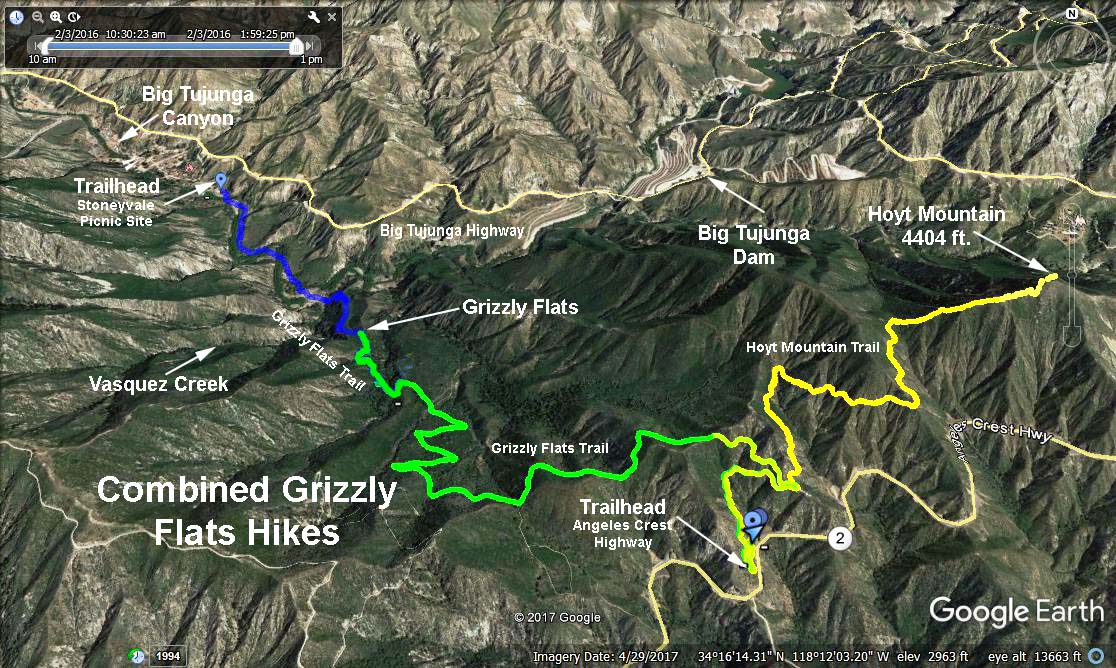
Hike #1297
Stonyvale Picnic Site to Grizzly Flat
October 26, 2016
Steve Babcock, Hike Leader
GPS Data:
Distance: 4.2 miles RT
Elevation Gain: 880 ft
Directions to Trailhead: From the westbound 210 Freeway exit at Lowell Ave and head north to Foothill Blvd. Turn left on Foothill, then right on Mt. Gleason Rd to Big Tujunga Canyon Rd. Turn right and proceed to Vogel Flat Road (mileage paddle 4.34). Turn right down to Stonyvale Rd then left to the picnic area. Restrooms available; national parking pass required.
From the eastbound 210 Freeway exit at Sunland Blvd, turn left under the bridge and continue east on Foothill Blvd to Oro Vista Ave. Turn left to the end at Big Tujunga Canyon Rd then follow instructions above.
The Hike: Head up canyon on the Grizzly Flat Trail crossing Big Tujunga Creek no fewer than 5 times in the first mile. If your rock-hopping skills are a bit rusty, be prepared to get your feet wet. The point where the trail leaves the canyon and starts up the mountainside is marked by a large pile of rocks. The second mile is very steep and rocky. Rest often, drink plenty of water and take in the magnificent views of Big Tujunga Canyon as you climb. The trail is a little overgrown with brush in spots but not bad - long pants might be advised. Watch out for poison oak as you approach Grizzly Flat. The leaves turn red in autumn so it is easy to spot. Take a break at Grizzly Flat then return the same way you came.
Those wishing more mileage can continue on the Grizzly Flat fire road all the way to Angeles Crest Highway or as far as you want (See instructions for Hike #1259).
With a 12.6 mile car shuttle, it is possible to do the 10.9 mile Grizzly Flat Traverse (See instructions for Hike #577).
Refreshments will be served on the picnic tables near the trailhead.
Google Earth - Combined Grizzly Flat (Blue Trace)
2020-11-21