GPS Data:
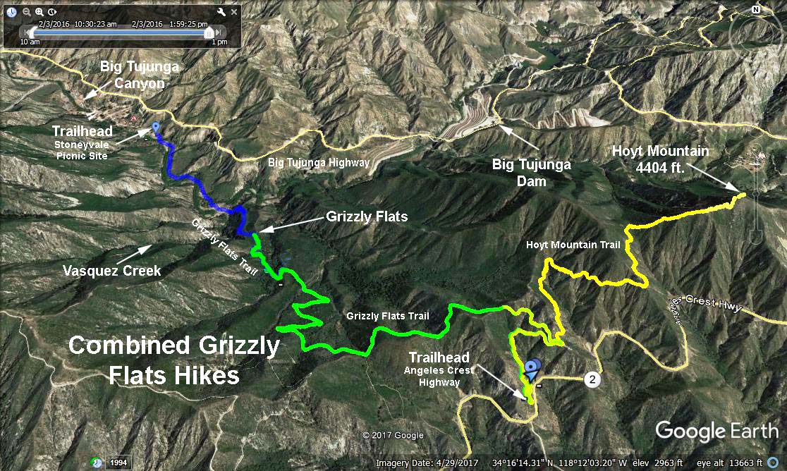
Distance: 5.5 mi one way.
Elevation Gain/Loss: 500 ft. gain, 1800 ft, loss.
Hike Discription: We all meet at the trailhead for Grizzly Flat. The hike takes us one way across the mountain to Vogel Flat. The first part of the hike will be on a fire road in high dry country so there will be no poison oak. The last part will be on a good trail down to and across Big Tujunga creek. We will most probably get our feet wet crossing the creek. There will be some poison oak as we leave Grizzly Flat. See who is first to spot the apricot tree on our way out.
Enough cars will be parked at Vogel Flat to take the drivers of the cars back to the Grizzly Flat Trailhead so that they can pick up their cars then return to Vogel Flat for their riders.
Shuttle: This hike will require a 12.6 mile car shuttle. Provisions shall be made so that enough cars will be placed at Vogel Flat and the drivers returned to the trailhead at Angeles Crest Hwy in time to start the hike at 9:30.
Directions to Vogel Flat: From the westbound 210 Freeway exit at Lowell Ave and head north to Foothill Blvd. Turn left on Foothill, then right on Mt. Gleason Rd to Big Tujunga Canyon Rd. Turn right and proceed to Vogel Flat Road (mileage paddle 4.34).
Directions to the Trailhead: From the 210 freeway in La Canada drive north 6.2 miles on Angeles Crest Highway, (SR 2) to mileage paddle 30.64.
The Hike: This will be a moderate hike. We hike 3.4 miles to Grizzly Flat gaining 440 feet elevation and losing 890 feet elevation. The lunch stop will be at Grizzly Flat. After lunch we hike about 2.1 miles losing 900 feet down to Big Tujunga Canyon.
Refreshmants will be served at Vogel Flat where sufficient restrooms are availanble.
Google Earth - Combined Grizzly Flat (Green & Blue Traces)
2017-07-27