Directions to Trailhead: 210 Freeway; exit at Base line Road. Left on baseline, within 1 block turn right on Padua Avenue. In 1.7 miles turn right on Mt. Baldy Road (stop sign). It's approximately 7 miles to Mt. Baldy Village. Just before you enter Mt. Baldy Village you turn left (west) on Glendora Mountain Road, and drive 1 mile to Cow Canyon. Park on the right side of the road, which is a large clearing.
The Hike: Cross the road and proceed past the locked gate up the fire road. Ascend a moderate grade and after 2 miles turn a hard left at a road junction, then left again at a second junction 1/2 mile farther. Follow the road that winds around the summit cone to the top. On the top, you'll find cement pillars and debris from the fire lookout tower that was once here.
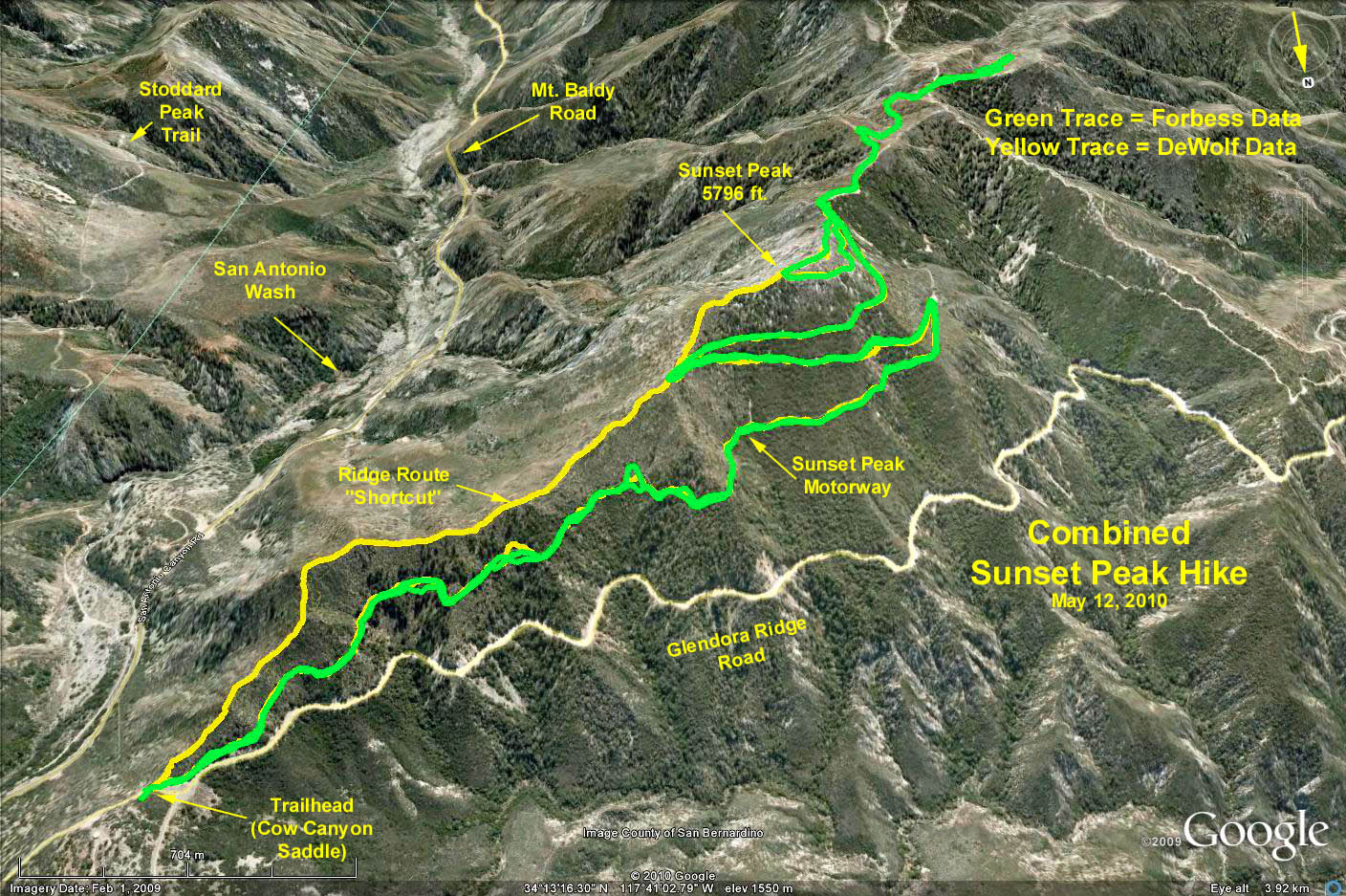
Google Earth Photo - Sunset Peak Hike
GPS Data: Trailhead elevation = 4535 ft.
Basic Hike (Green trace to the peak and return) = 7.2 mi round trip. Peak elevation (from Topo) = 5796 ft, although GPS data = 5788 ft. Peak elevation change = 1248 ft.
Green trace out and back = 9.3 mi round trip which included an extra 1.1 mi and 400 ft. elevation change up and back toward the peak with the antennas. Accumulation of elevation was 1600 ft.
Yellow Trace = 5.5 mi round trip. Description: "We walked up the road to the first turn. At the second turn we veered off to the left and up the ridge directly to Sunset Peak. On the way back we took the same road everyone else took, but when we got to the place we left the road on the way up, we went down the ridge to the parking lot, avoiding a long switchback." (That saved them 2.3 mi, however, the last leg of the scramble was very steep, falling 867 ft. in the last 1.2 miles, that is 700 ft/min or a 14% slope. Must have been fun!