GPS Data:
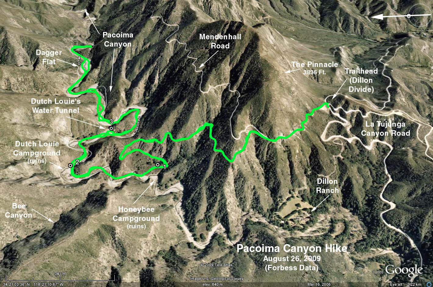
RT (out to Dagger Flat & return) = 7.2 mi. and 500 ft. elevation change.
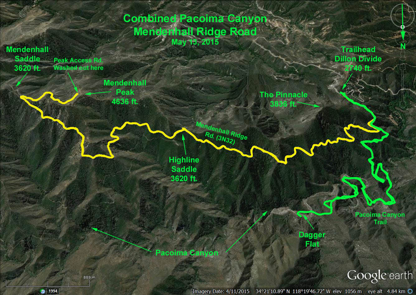
RT (to Mendenhall Peak & return) = 11.6 mi. and 1800 ft. elevation gain
Directions to Trailhead: Exit the 210 Freeway at Osborne St. For those travelling from the west, turn left at the bottom of the off-ramp onto Foothill Blvd, go under the freeway, then turn left on Osborn St. (which ultimately becomes Little Tujunga Canyon Road). For those travelling from the east, turn right at the bottom of the off-ramp onto Foothill Blvd. then turn left on Osborn St. Follow the large signs to the Wildlife Waystation. Note speedometer reading upon reaching Osborne St. Checkout the restaurant in the shopping area on your left for a possible pit-stop since there are no other restrooms available on the hike.
Continue up Little Tujunga Road 7.4 miles (passing the ranger station, Gold Road and the Wildlife Waystation) to the fire road 3N32 intersection. There is a small clearing on both sides of the road with white pipe gates blocking the north/south access to the dirt fire road. This is the Dillon Divide, our trailhead. There is room for possibly 7 cars on the north side if parked head-in, and perhaps 2 or 3 cars on the south side. Otherwise, park with care along side of the road before or after the gate.
The Hike: Starting from the north side of the Dillon Divide take Mendenhall Ridge Road (3N32) approx. 0.4 mi to a trail opening off the left side of the road marked by a bullet-ridden faded yellow metal pole. The trail, an old road, descends contouring down the side of the canyon to its bottom where the road ends. The canyon bottom trail crosses the stream bed many times. Look for "ducks" on opposite side of the stream where the trail picks up again. Continue upstream to a wide place, the former site of Dutch Louie's campground (no trace remains). Beyond Louie's campground is Dutch Louie's mine, a hole in the rock face hidden behind some bushes on the left side of the canyon. Dagger Flat, a large open area, comes next as we hike further into the canyon, and beyond, the canyon narrows significantly. Continue upstream as far as you wish. Vestiges of a trail disappear - just pick your way over the streambed rocks and "islands". Return the way you came.
Optional Hike: Hike the Mendenhall Ridge Road as far as you wish. Note: It is 5.8 mi one way from the trailhead to Mendenhall Peak (turn right at the fork leading up to the peak) with 1798 ft. elevation gain.
Refreshments back at the trailhead.
Google Earth Photo - Combined Pacoima Canyon/Mendenhall Peak Overview