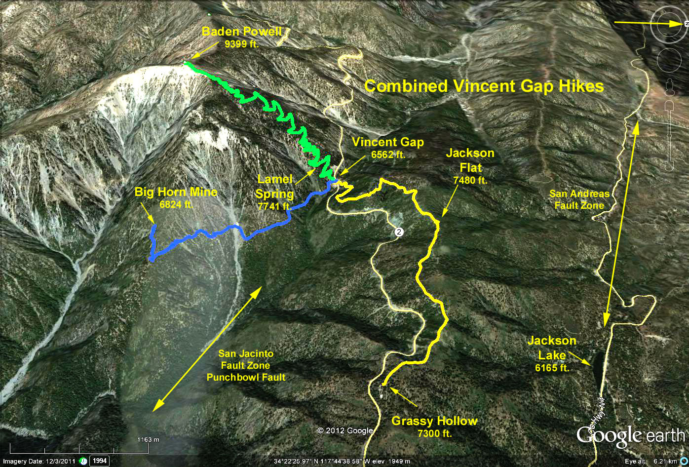
Trailhead: Vincent Gap at paddle 74.80, about 50.4 miles (1 hr 20 min) up Highway 2 from the 210 freeway.
Summary: Three hikes can be done from Vincent Gap. The Baden Powell hike is strenuous because of the 6590 foot altitude at the start and altitude gain of 2800 feet. It is 8 miles RT. The Jackson Flat hike to Grassy Hollow Campground is moderate, 6 miles RT 950 feet elevation change. The hike to Big Horn Mine is 4 miles with 300 ft. elevation change.
The Baden Powell trail begins ascending immediately, with about 3 dozen switchbacks in all. In 1.5 miles, an unmarked side trail leads 100 yards to Lamel Spring. One mile from the summit, at 9000 feet, you will start to see limber pines and soon will intersect a side trail with a tiny sign pointing to a limber pine stand. After a few more switchbacks atop a ridge you can glimpse Mt. Baldy. Further along the ridge and barren crest, you will intersect the Pacific Crest Trail which swoops off to Little Jimmy Spring, but don't go that way. Continue to the summit. Return the same way.
The Jackson Flat hike, is steady moderate climb (950 feet) along a dirt fire road which parallels the Pacific Crest Trail. The hike starts across the highway from the trail to Baden Powell. Jackson Flats campground is about 4.25 miles out. At the campground, there is a nearby geology trail, an observation platform on a water tank and from a ridge top there is a view out over the desert.Continuing on, you eventually come to the Grass Valley Campground which is just off of Route 2. Return the way you came.
The hike to Big Horn Mine heads south out of the parking lot on the dirt road just to the left of the Baden Powl trailhead. The road skirts around the east flank of Baden Powell. After about 1 1/2 mile you pass a small mine tunnel. Beyond that, the trail rounds the Big Horn complex where the massive butress of Baden Powell and the deep gorge of the east fork of the San Gabriel river and its tributary canyons come into view. Beyond looms the grayish mass of Old Baldy. The trail rises about 300 feet to top a ridge and passes the foundations of the mine buildings. Rounding the final bend, the old stamp mill comes into view. At this point the trail ends. There remains much evidence of the mine operations, although it is not recommended that you attemp to enter the mill. Return by re-tracing your steps.
A more strenuous alternative is a ONE WAY "SHUTTLE": Get dropped off at Dawson Saddle, hike up to top of Baden Powell via Troop Peak (9138 feet) and Mt. Burnham (8997 feet) returning to Vincent Gap. This alternative is about 8.5 miles with 2500 ft. gain to the peak, and then another 4 miles and 2800 ft. loss to Vincent Gap. Dawson Saddle trailhead occurs before Vincent Gap at paddle 69.59, about 45.2 miles (1 hr +) up Highway 2 from the 210 freeway.
Reference: 1998 "Day Hikers Guide to Southern California" by John McKinney.
Google Earth photo - Combined Vincent Gap Hikes
GPS Data:
Baden Powell Hike:
RT = 7.2 mi.
Trailhead = 6562 ft.
Peak = 9399 ft.
Max Elevation Change = 2837 ft.
Jackson Flats Hike:
RT = 6.0 mi.
Max Elevation = 7500 ft.
Max Elevation Change = 938 ft.