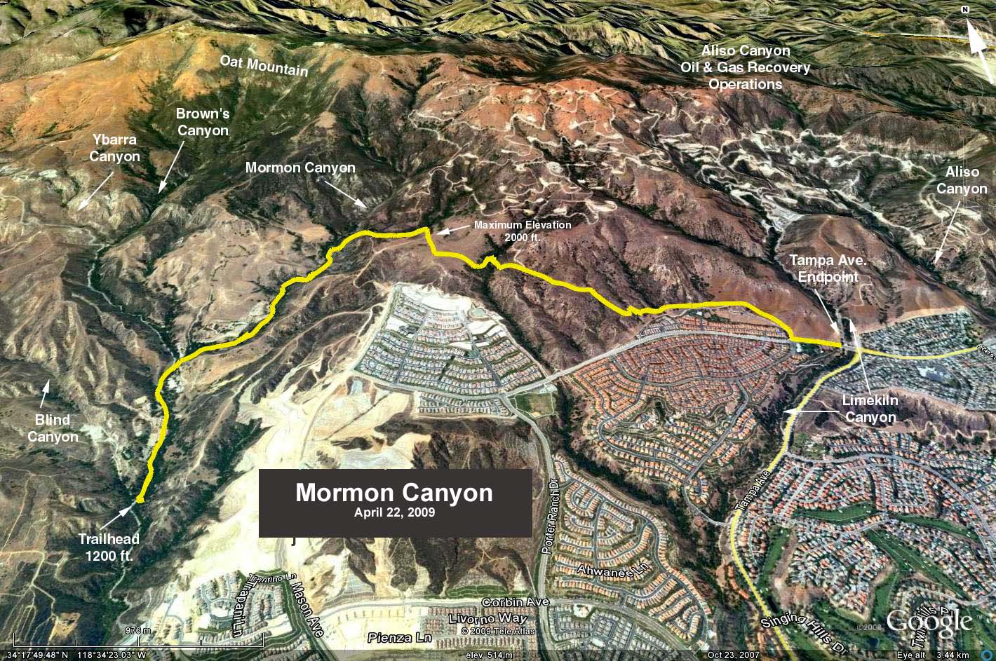
GPS Data:
RT = 7.6 miles
Elevation Gain = 740 ft.
Directions to the Trailhead: Exit the 118 Freeway on Desoto Ave. and go north which immediately makes a sharp right turn. Proceed up Brown's Canyon 1.1 miles to a small parking area on the left marked with a green Conservancy sign.
The Hike: The trail up Morman Canyon leaves Brown's Canyon at about 0.6 miles up canyon from where we park. We then hike up Morman Canyon, which was ravaged by the recent Sesnon fire, for 1-3/4 miles where there are the remains of an olive grove (the last vestiges of farming in this area left by Mormon immigrants to California).
At that point the trail crosses a road and becomes a narrow single-file path. Continue through a nice little canyon until you come to a well maintained road where you turn right. The road terminates at a gate. Take the trail left until you reach Tampa Ave. about 3.5 miles from the start.
Return to cars for refreshments.