Directions to Trailhead: From Corona, drive south on I-15 past Lake Elsinore, to an exit named Clinton Keith. Turn right on Clinton-Keith. After about two miles, stop at the visitor center to pay $2 per person fee to Nature Conservancy custodians, and grab a map of the plateau. There are bathrooms there.
Then continue on the road past Hidden Valley parking area to the Vernal Spring Trailhead. Parking is along the road and there is a portapotty there.
The Hike: You will have a choice of several hikes, short, medium and long on the many trails throughout the plateau. Please stay within a group of 2, 3, 4 or whatever as there have been sightings of a cougar in the past. Use a hiking stick and have strong lungs.
Extra note: If you leave early and would like to stop for breakfast there is a Denny's in Lake Elsinore which is about 4 miles before the Clinton-Keith exit. Take the Diamond Drive exit off the I-15. The Denny's is on the left of the freeway
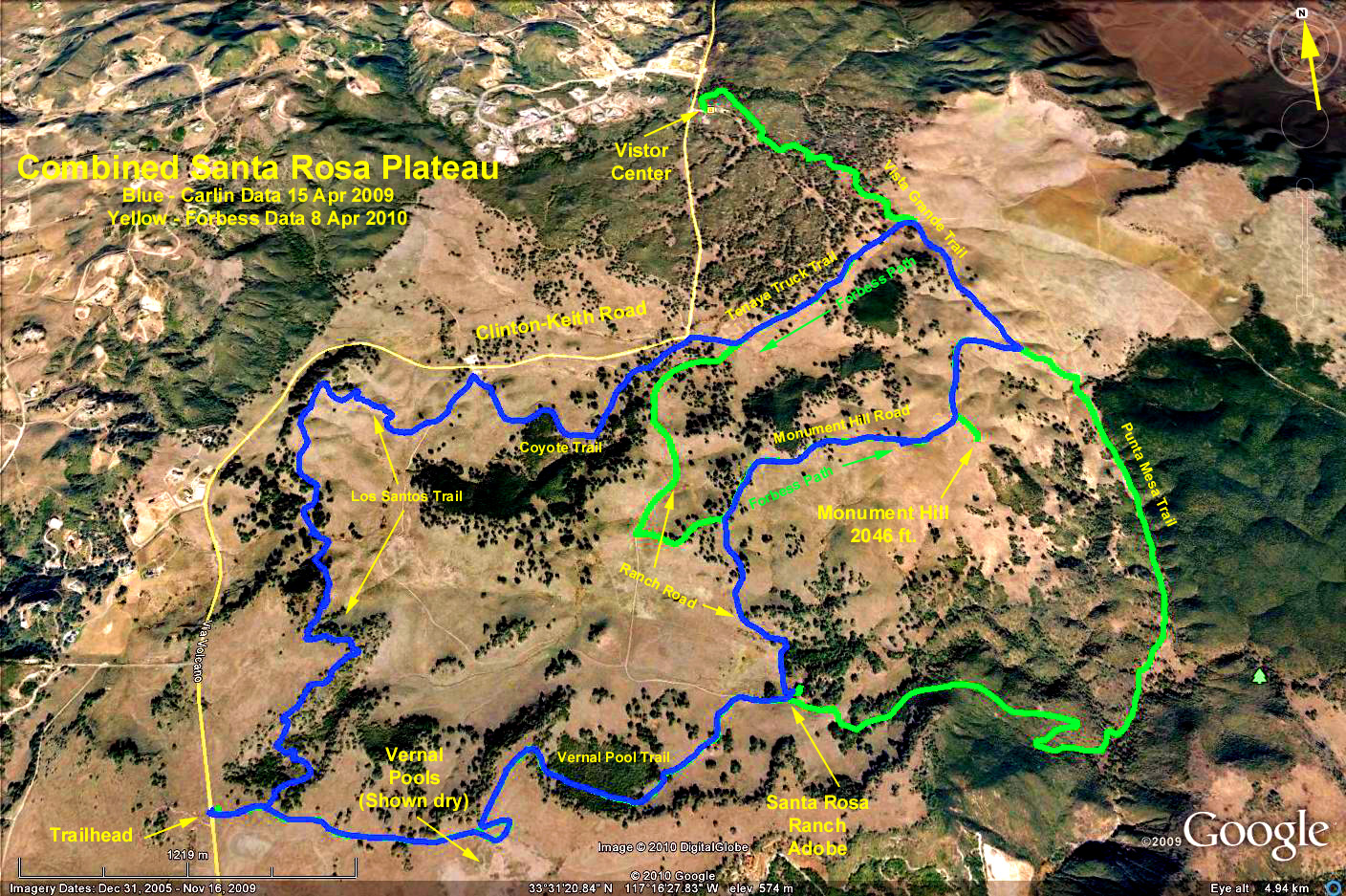
Google Earth Photo - Santa Rosa Plateau
GPS Data:
Blue data taken 15 Apr 2009. Hike started from and ended at the Vernal Spring Trailhead.
Total RT miles = 9.2 mi.
Highest point was at the trailhead = 2060 ft.
Lowest in the meadow = 1760 ft.
Delta of 300 ft.
Green data taken 31 March 2010. Started from the Visitor's Center, circle in to the meadow on the Tenaja Truck Trail, climb Monument Hill (2046 ft.) via the Monument Hill Trail, then circle around past the adobe ranch house, the vernal pools, ending at the Vernal Spring Trailhead.
Total miles = 9.3.
Highest point = 2080 ft.
Lowest point = 1580 ft.
Delta = 500 ft.