Directions to Trailhead: You will need to get to 5 freeway just after its junction with the 405 freeway in Orange County. Exit on El Toro Road. You will need to do a quick left to get to El Toro Road North. The total mileage from El Toro Road North to O'Neil Park is 15.4 miles (allow 30 minutes). After 7.6 miles on El Toro Road, you will reach Cook's Corner (famous weekend motorcycle hang out). Bear right (Live Oak Canyon Road) and proceed the last 7.8 miles to the O'Neil park entrance on the right. The cost is $3 per car (it is a county park). Don't forget to ask for a hiking map. Do a quick right and you will see the Live Oak parking lot where we will be starting the hike.
The Hike:
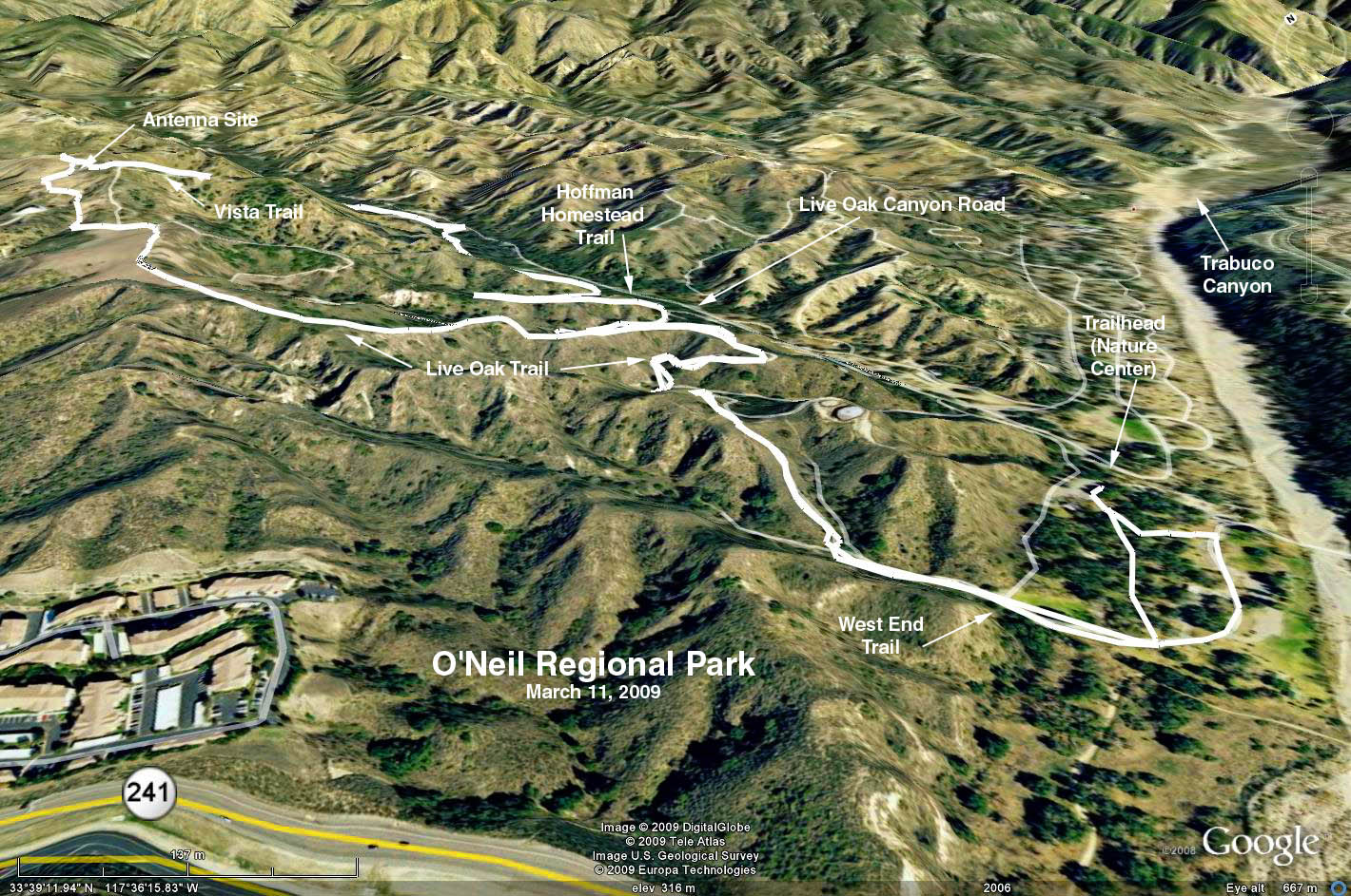
Lookout Hike: 5 miles---moderate uphill to a beautiful 360 degree view of Orange County. The elevation change is just over 1000 feet but the path is smooth and rises slowly. Suggested route is Live Oak Trail to Vista Trail and return to the parking lot via the Hoffman Homestead trail
Arroyo Trabuco Wilderness Trail: 10 miles round trip - virtually flat trail through a lovely canyon living in harmony with the developments just out of view. The area is filled with trees and vegetation and is a very pleasant, if not a challenging hike
Google Earth Photo - O'Neil Regional Park
GPS data:
RT = 5.3 mi.
Trailhead Elevation = 877 ft.
Maximum Elevation Change = 625 ft.