Distance: 7 miles RT.
Elevation gain: 700 ft.
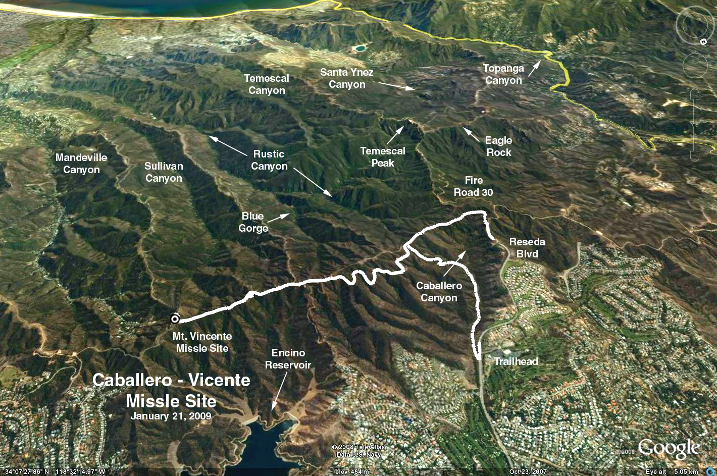
Directions to Trailhead: From the 101/405 interchange, go north (west) on the 101. Get off at Reseda Blvd. and go south past Ventura Blvd. After about 2 miles, you'll come the entrance of Braemar Country Club on your right. The trailhead is directly across the street from the entrance and is marked by a sign that reads, "Santa Monica Mountains Conservancy". Park on both sides of the street at the trailhead, however, you might want to take a run up to the top of Reseda Blvd. where there are port-a-potties.
The Hike: From the trailhead, the trail immediately starts its descent into Caballero Canyon. You'll be heading south parallel to and slightly below Reseda Blvd. After about a half mile, you'll cross a creek and reach a fork. Take the left fork, away from the creek, and start to ascend. Caballero Canyon Trail ends at "dirt" Mulholland Drive.
A sign there that says, "San Vicente Mountain Park/Nike Site 2.2 mi." with an arrow pointing to the left. Take the left and proceed east along Mulholland to the Nike Site. It's a good place for lunch with picnic tables and super restrooms (toilet paper and seat covers). Since you're there, take an extra 10 minutes to read about the Nike site details and climb up the tower. There is a gorgeous view from atop the tower of Burbank, downtown LA, and Santa Monica Bay down to PV.
We return different way by taking Mulholland back, past the junction of Caballero Canyon Trail, to the Marvin Braude Mulholland Gateway Park (at the top of Reseda Blvd.) where we'll have refreshments. Follow the signs that say, "To Reseda Blvd."
NOTE: The hike leader should position some cars up at the top of Reseda to shuttle the drivers back to their cars at the trailhead.
Google Earth photo - Mt. Vincent Missile Site from Caballero Canyon
GPS Data:
RT = 7.8 mi.
Max Elevation gain = 910 ft.