Distance: 6 miles RT
Elevation gain = 1300 ft.
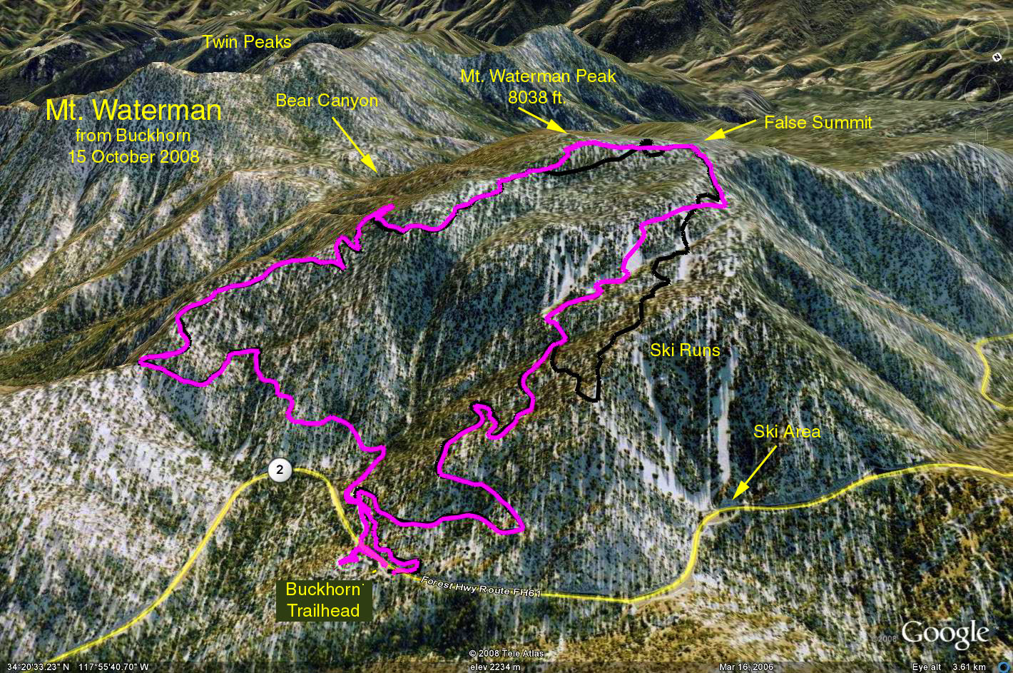
Direction to Trailhead: Drive the Angeles Crest Highway to a point near highway mileage marker 58.00, 34 miles from La Canada. The trailhead is marked with a sign that simply says TRAIL. There is also a sign that says San Gabriel Wilderness, Angeles National Forest.
The Hike: Walk about 30 ft. up the fire road, and then go left on a section of trail that parallels the highway for a short distance and begins to ascend the forested slope. After climbing southward through tall stands of Jeffrey pine and incense cedar for 1.25 miles, the trail reaches a saddle on Waterman's east ridge. From here you can look down into the wild upper reaches of Bear Canyon and to Twin Peaks beyond. The trail now turns west and climbs to a junction with the Twin Peaks Trail, 0.5 mile. The trail does not reach the actual summit of Waterman. When it turns northwest and begins to descend, leave the trail and head southwest, past a subsidiary summit, about 500 yards to the true summit.
A shorter, 2.5 mile hike can be done by hiking to the saddle on Waterman's east ridge. Return by the same route.
Another alternative is to ascend from Buckhorn and descend the west ridge to Three Points. If you plan to do this, you will need to arrange to leave a vehicle at Three Points for the shuttle back to the trailhead. This produces a 1300 ft. gain and 2100 ft. loss. The total distance is about 8 miles.
Google Earth photo - Mt. Waterman Loop
Refreshments at the trailhead.
GPS Data (Magenta Track):
RT = 6.0 mi.
Trailhead = 6688 ft.
Max Elevation Change = 1330 ft.