Distance: 8 miles round trip.
Elevation gain = 1000 ft.
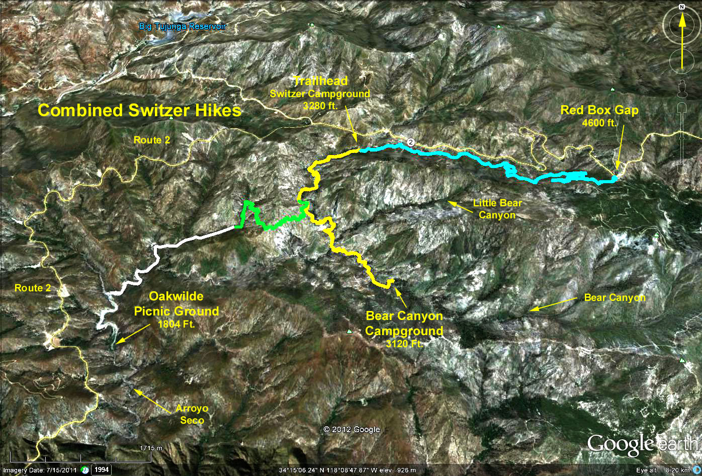
Directions to Trailhead: Drive up the Angeles Crest Highway from La Canada for 10 miles. About 0.4 miles after passing Clear Creek junction, look for the turnoff to Switzers on the right. Drive down to the Switzer Picnic Area parking lot and park. There are toilets in the picnic area.
The Hike: After crossing the bridge, follow the trail down the canyon, boulder bounding where necessary. After a mile, the ruins of Commodore Switzer's Camp are reached, at which point we cross the stream and continue up hill as we climb up and over the west slope above the falls. At one point, the falls come into view nestled in the rock face far below us.After we reach the top of our climb, we head left at a junction of two trails, one to Bear Canyon (left), and one to Oakwilde Campground (right). We continue, descending into the Arroyo Seco gorge.
Upon reaching the creek, we head downstream past a series of cascades and pools - certainly the most beautiful and peaceful trek in all the San Gabriels. Along the way, we pass the junction of the Arroyo Seco and Bear Creek, noting the change in direction of water flow. Eventually, we come to a slight incline leading up out of the stream bed to Bear Canyon Campground. There are picnic tables and toilets in the campground.
Google Earth photo - Switzer to Bear Canyon Campground
GPS Data:
RT = 7.5 mi.
Max Elevation change = 960 ft.