DISTANCE: 9 miles
GAIN: 500 feet
DIRECTIONS:
From 405 Freeway, take Hawthorne Blvd exit south (right) approx. 5 miles to Palos Verdes Drive North (stoplight). Turn west (right) for ½ mile (past Silver Spur stop sign) and turn north (right) at the start of the center divider to Ponderosa Lane.
From 110 Freeway, exit Pacific Coast Highway west (right) approximately 5 miles to Hawthorne Blvd (stoplight). Turn south (left) approximately 1 mile to Palos Verdes Drive North and follow subsequent directions above.
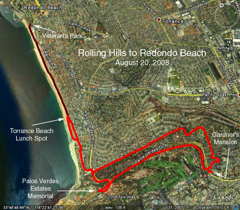
HIKE: We will take various streets and trails to the Torrance Beach paved walkway to Veterans Park for lunch and a slightly varied route back to Ponderosa Lane for refreshments. Route will maximize shade except for three beach portions. Detailed maps and directions will be provided. Shorter versions can be easily formulated by turning back before Veterans Park.
Google Earth photo - Rolling Hills to Redondo Beach Veteran's Park
GPS Data:
RT = 8.9 mi.
Trailhead = 440 ft.
Max Elevation Change = 440 ft. (down to waters edge).