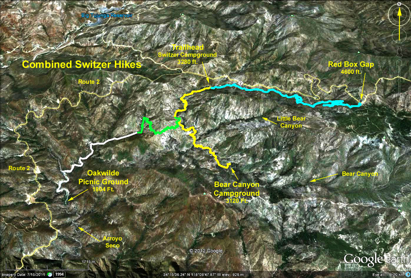
Distance: 4.2 miles one way
Elevation gain: 1340 ft. (Switzer to Red Box).
Directions to Trailhead: Drive up the Angeles Crest Highway from La Canada for 10 miles. About 0.4 miles after passing Clear Creek junction, look for the turnoff to Switzers on the right. Drive down to the Switzer Picnic Area parking lot and park. There are toilets in the picnic area, and up at Red Box.
The Hike: The hike starts by going beyond the eastern end of the parking lot picking up a trail that traverses the canyon leading up to the west slope of Red Box Gap. (Angeles Crest Hwy., running from Clear Creek junction to Red Box, is built along the north slope of this canyon). Lunch will be at Red Box then return by the same trail. The trail is fully shaded with many scenic views.
For those preferring a shorter hike (4.2 miles), there are two options, both involving a coordinated shuttle. Those hikers wanting to go downhill would drive up to Red Box and hike back down to Switzer. They would park the car at Red Box and hide the key in an appropriate spot. Those hikers wanting an up-hill hike would hike up to Red Box, find the key, and drive back to Switzer.
Google Earth photo - Switzer to Red Box
GPS Data:
RT = 8.7 mi.
Max Elevation change = 1300 ft.