Distance: 8 miles RT
Elevation gain: 1250 ft.
Directions to Trailhead: From 101 freeway in Thousand Oaks area, go north several miles on Kanan road. After Kanan sweeps westerly, proceed past Oak Park High School campus on the left, to Hollytree Drive at a signal light and turn right. After several 100 yards turn left into Oak Canyon Community Park, and continue past the first parking lot entrance and park in the second parking lot on the left.
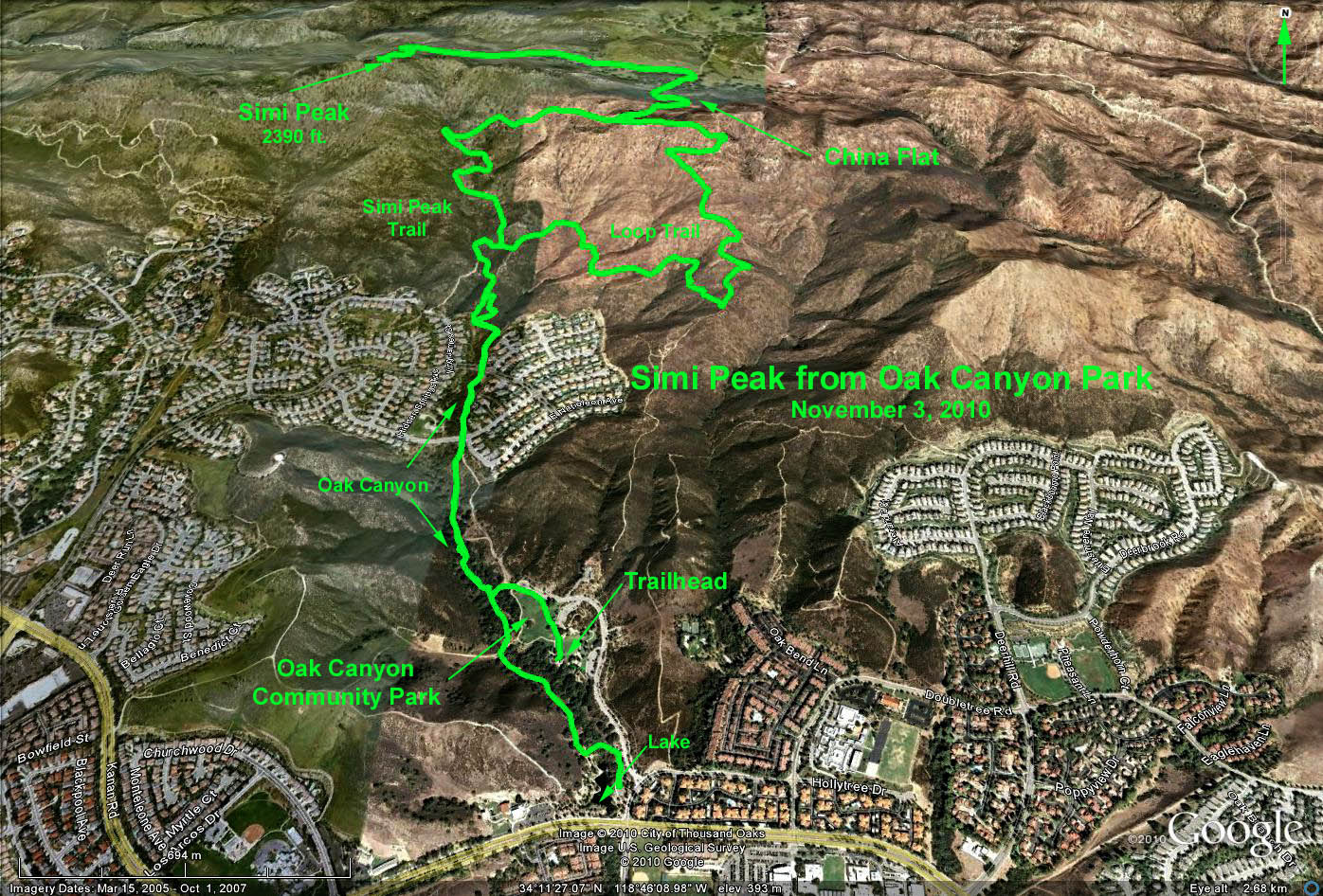
The Hike: The first segment is a trail that runs northward along Oak Canyon which serves as the west boundary of the park. From the trailhead, proceed west past the covered picnic area down to the trail, and turn right. After about 0.5 mile we regain the park road, and cross Bromley Dr. We continue on the oak shaded trail, crossing Lindero Canyon Road and on up the hill. After a sharp turn to the left continue to a fork, whose either choice (one steeper than the other) will reach the China Flat Trail.
Once atop the flat, continue past the 2 iron gates and some minor trail junctions on into a heavily wooded canyon, choosing the left fork at the junction with the Palo Commado trail. Continue generally west eventually climbing Simi Peak.
Return the way you came. An alternate trail can be taken at the junction just beyond the iron gates by turning left and following the trail down the mountain to another fork. Taking the right choice - the loop trail - traverses back across the mountain eventually junctioning with the Simi Peak trail, or proceeding straight ahead brings you steeply down into Oak Canyon Park.
There are many trails around the lake area (located just west of the first parking lot) where there are ducks, fish, turtles and many birds to identify. You will see several spring fed waterfalls.
Refreshments at the picnic area just west of the parking lot.
Google Earth photo - Simi Peak from Oak Canyon Park
GPS Data:
To China Flat: RT = 5.4 mi.
Max elevation gain: 1050 ft.
To Simi Peak (from lake), return via loop trail: RT = 8.2 mi.
Max Elevation gain: 1300 ft.