Distance: 6 miles
Elevation Gain: 700 feet
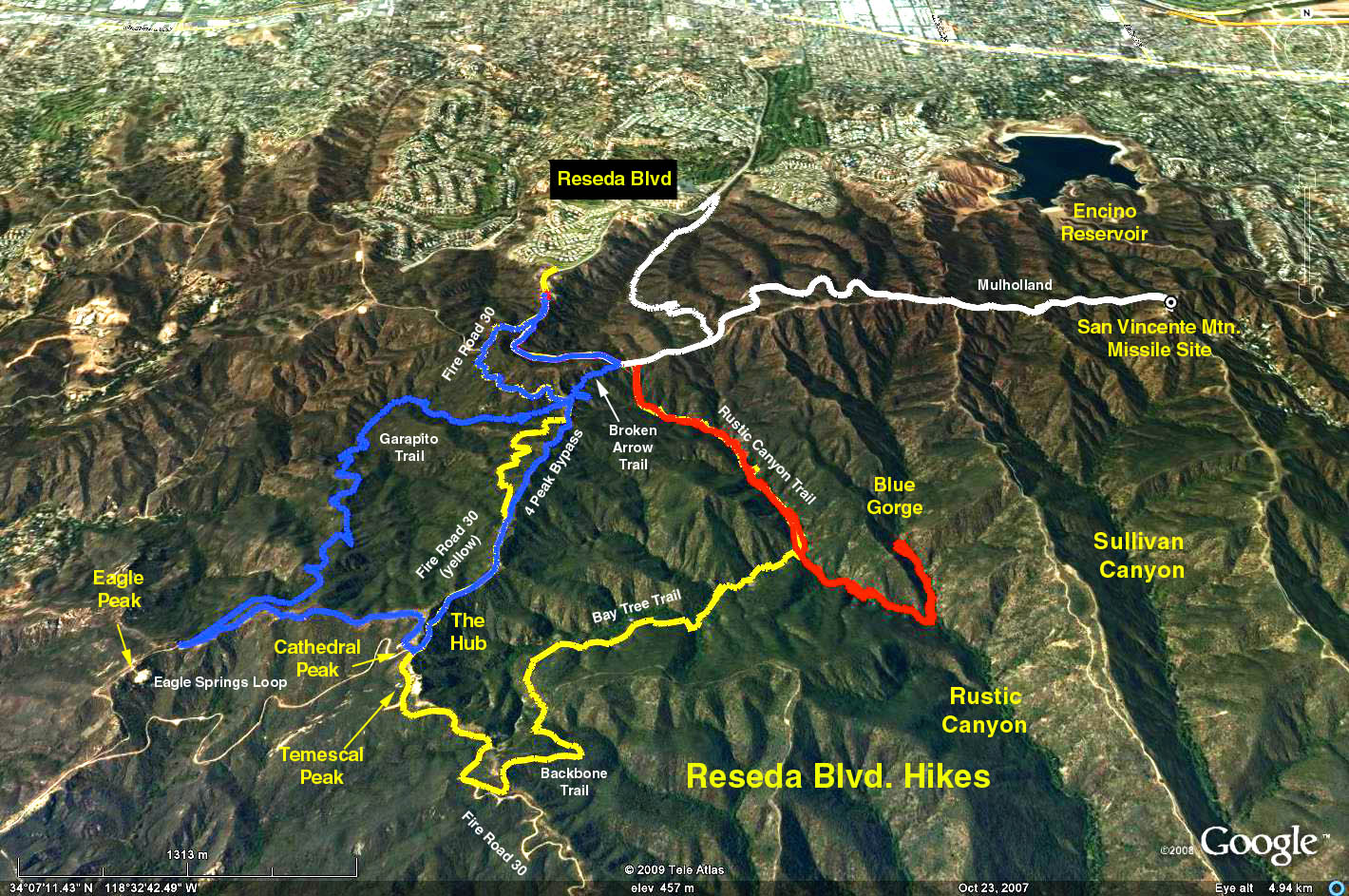
Directions to Trailhead: Exit 101 at Reseda Blvd. and proceed south past the Braemar Country Club and golf course, up the hill and park below the fee area for free, $3.00 if you don't want to walk up the hill (.2 mile or so).
The Hike: We walk straight up the extension of Reseda to Mulholland and turn east (left), walking along Mulholland to power pole #12509M. We then take the Rustic Canyon trail, across from the pole (WP2), down to the bottom of Upper Rustic Canyon. We walk south-east along the heavily shaded canyon stream bed to the entrance to the Blue Gorge (WP3) (actually one of the east forks of Rustic Creek) along a track that is wet/muddy stream bed with occasional trails to bypass stream debris. Both tracks are strewn with good sized rocks (NOT boulders) and slippery Sycamore leaves, all of which makes hiking a bit tricky. Beware of the ever present POISON OAK.
Turning left, the .5 mile trek up the east fork presents a similar path except much narrower and more overgrown with thorny vines. We should certainly see water under-foot, as well as lots of Santa Monica Slate - the blue-gray rock of Blue Gorge, mud which was deposited some 150 million years ago when this area was under water, and then was metamorphosed into slate.
The canyon narrows to perhaps 15 ft., then a 3 ft. waterfall, and then suddenly a 30 ft. high slate wall appears ahead, another waterfall and then a narrow 15 ft. long flat area (WP4) and another 5 ft. waterfall. Moss and ferns grow from the walls. Bees buzz in and out of the narrow space, and in one place, limestone has percolated down and left a light textured pattern deposited on the canyon wall.
Caution: This hike is more difficult than the stats indicate. GPS data is provided below and its use is heavily recommended because main canyon course, and all of side canyons look identical.
Return the way you came.
Google Earth Photo - Rustic Canyon: Blue Gorge
GPS Data:
RT = 5.9 mi.
Elevation gain = 740 ft.
Key Way Points
WP1 - Trailhead: N34 7.899 W118 33.185
WP2 - Rustic Canyon entrance off Mulholland: N34 7.556 W118 32.819
WP3 - Gorge entrance off Rustic Canyon: N34 6.615 W118 31.948
WP4 - End point in gorge: N34 6.856 W118 31.991