Distance: 9 miles RT
Max elevation: 1200 ft.
Directions to Trailhead: Take the 71 freeway south (or north as applicable) and exit at Lambert Road and head east. Lambert Road becomes Carbon Canyon Road. Turn right into Chino Hills State Park, turn left after the entrance station, and drive 0.4 miles to the far side of the parking lot.
The Hike: Our hike starts by hiking east about 0.4 mi. to a 3-way junction of the Carbon Canyon, North Ridge and Telegraph Canyon trails. Proceed upwards on the North Ridge trail about 3.5 mi. to a junction with the Gilman Peak trail. CAUTION: There is an earlier junction with the Gilman Peak trail that bypasses the peak. Turn a sharp right and head southward up to the peak with great views of Orange County.
Continue hiking southward on the Gilman Peak trail down into Telegraph Canyon and turn right onto the Telegraph Canyon trail. Proceed another 4 miles west to the trailhead, bypassing junctions with the Easy Street and Diemer trails along the way, and the 3-way junction mentioned above.
Refreshments back at the trailhead.
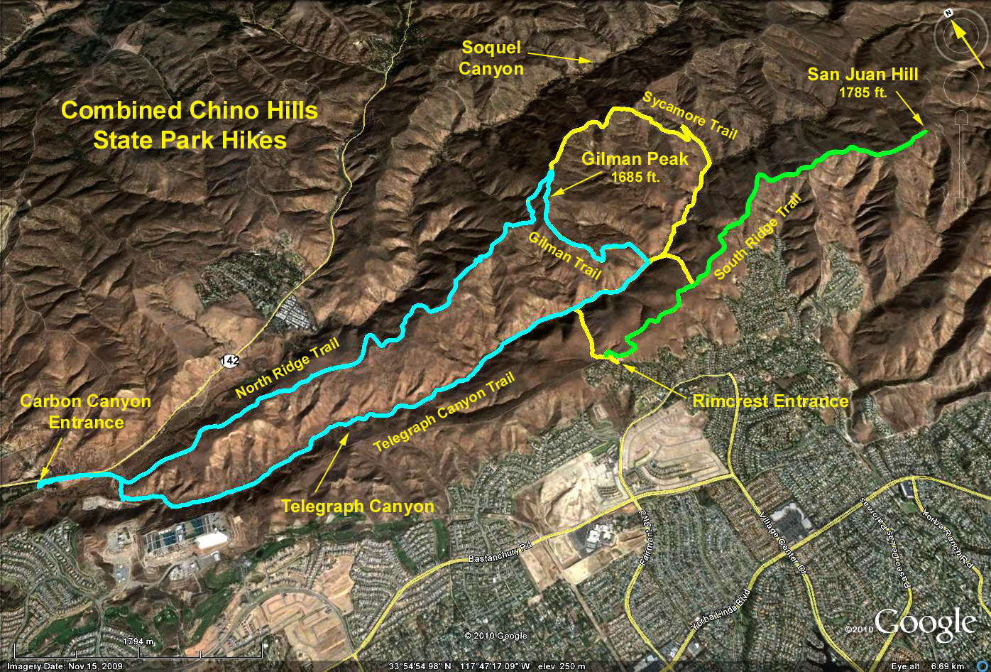
Google Earth Photo - Chino Hills State Park
GPS Data:
RT = 9 mi.
Elevation gain = 1200 ft.