Distance: About 9 miles round trip
Elevation gain: About 1600 ft.
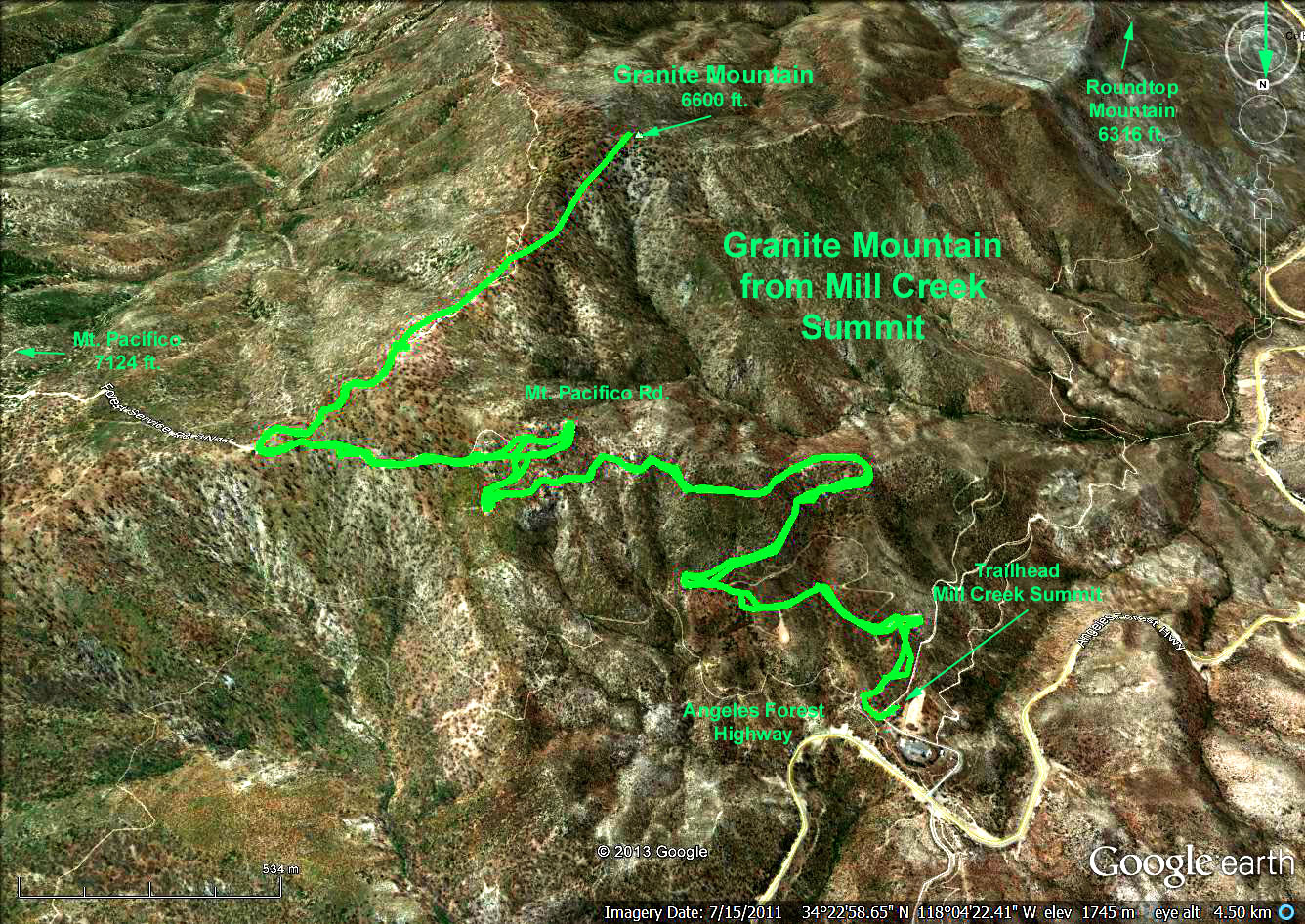
Directions to Trailhead: The starting point, Mill Creek Summit, is 24 miles from La Canada by way of Angeles Crest and Angeles Forest highways. When you approach the summit, youll see a picnic area on the south side. Turn south on a paved side road here and drive 0.3 miles to a PCT trailhead parking area.
The Hike: Is all on dirt roads up to the last about 0.4 mile. The first part is on the Pacifico Mountain Road, which actually runs from Mill Creek Summit past Pacifico Mountain to Chilao Flat. Stay on this well maintained road and dont stray onto lesser side roads. At about 2-1/2 miles turn right on the road to Granite Mountain and Roundtop Campground. This turn is very well marked by a sign that says Granite Mountain in 1 mile.
Hike along the Granite Mountain road about 0.6 miles. Most of this will be downhill. When you get to the bottom of the downhill, look to the right, and youll notice several 3 foot tall posts in the ground. Walk between these posts and upslope about 200 feet until you come across a trail running upslope to the left. Follow this to the peak. The trail follows the ridgeline. Return the same way.
If anyone wants to do an 11 to 12-miler, you can skip Granite Mountain, and just continue past it on the road to Roundtop Mountain.
Google Earth photo - Mill Creek to Summit Granite Mountain
Refreshments will be served at the trailhead parking lot.
GPS Data:
RT = 8.5 mi.
Max Elevation Change = 1510 ft.