Distance: 5 miles RT or less
Elevation Gain: 450 ft.
Directions to Trailhead: Valley folks can take Topanga Canyon Road to PCH, and then south to Sunset Blvd. About 3 miles up Sunset turn left on Will Rogers State Park Road. Alternately, take the 405 freeway to Sunset Blvd, go west about 6 miles, and then right on Will Rogers State Park Road.
Coming from the south, take PCH to Sunset Blvd. and follow instructions above. Note that there is a parking fee or you can use a pass from the California State Park Foundation.
The Hike: To get to the trailhead, follow the road down past the Parking Kiosk. Go right on the 1st road; go past 2 houses and cross the field diagonally to the entrance to the trail. The trail from the parking lot is closed due to dangerous conditions. There are very few trail markers along the way. At the bottom of the canyon, cross the road and continue the hike on the dirt trail. Later, turn left at the sign that says "SMMNRA Hiking Trail - Unsafe for Horses". Its quite safe for humans.
Much of the trail is shaded. Warning: watch out for poison oak. There are bathrooms at both parks.
For those wanting additional hiking distance, you can choose to hike the Temescal Canyon trail to the waterfall, or hike on the Temescal Ridge Trail. Alternately, you can go back to Will Rogers & hike around the grounds or do the Inspiration Point Trail. The Temescal waterfall is listed as 2.6 miles round trip from Temescal Gateway Park. The Will Rogers Inspiration Point Loop Trail is 4.0 miles round trip.
There is a very interesting video about Will Rogers in a building behind the Ranch House from 10 AM to 4 PM, and tours of the Ranch are at 11:00 AM, 1:00 & 2:00 PM.
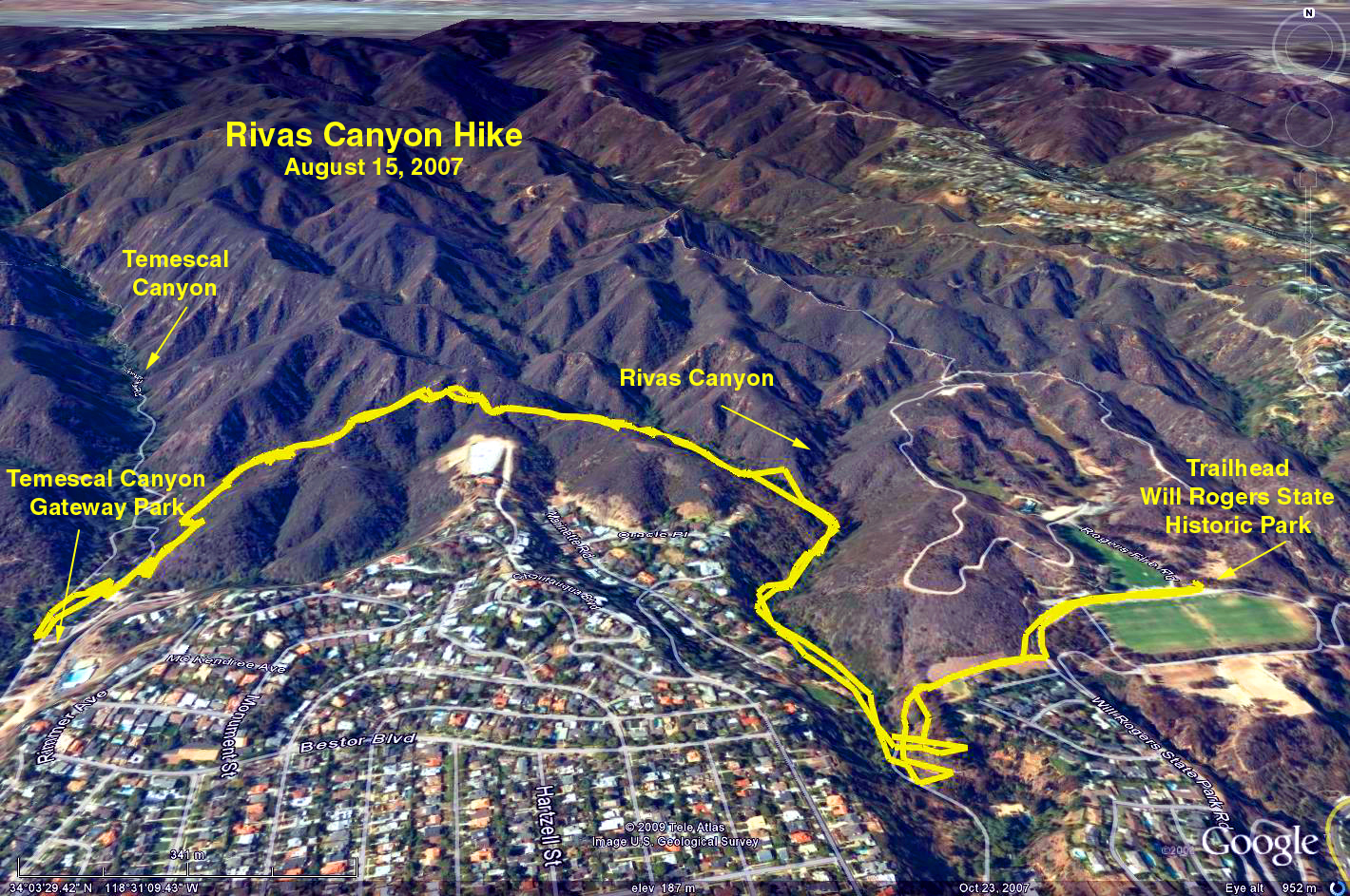
Google Earth photo - Will Rogers to Temescal Canyon via Rivas Canyon
Original 2007-08-15 Hike 865 Description
GPS Data:
RT = 5.2 miles
Elevation gain = 425 ft.
2017-07-08