Directions to Trailhead: From the I-5 North, merge onto CA-14 toward Palmdale. Go 8.5 miles and exit at Sand Canyon Road. Turn left on Sand Canyon and contnue for 2.0 miles. Turn right on Sierra Highway. NOTE: Resist the urge to take the Sierra Highway exit off of CA-14 when it occurs prior to your reaching Sand Canyon Road.
After 0.3 miles on Sierra Highway, turn left onto Vasquez Canyon Road. Drive 3.6 miles, and turn right onto Bouquet Canyon Road. Drive 11.5 miles, and turn left onto Spunky Canyon Road. Drive 2.6 miles and park in the huge lot on the left side of the road.
The Hike: We start on a road for several hundred feet until we see a thin tan Forest Service sign that says, "No Motor Vehicles." We take the trail near this sign for 1.5 miles to the highest summit at 4,996 feet and a view of the old town of Green Valley, Bouquet Reservoir, and San Francisquito Canyon.
We can return at this point the way we came, or continue another 2 miles to a lower summit at 4431feet. The adventurers may want to descend to a plateau at 3051 feet for another 2 miles beyond the summit.
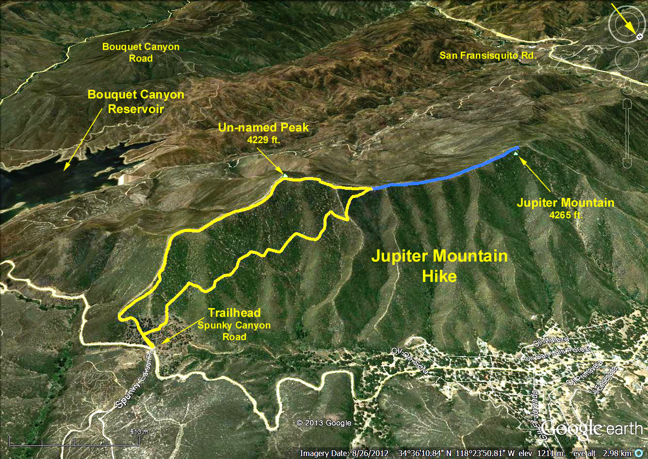
Google Earth photo - Jupiter Mountain
GPS Data: NOTE: The hike leader errored by leading us up the very steep western slope of the mountain instead of the trail we should have hiked up (yellow trace). Some hikers continued to Jupiter Mountain (blue trace).
Yellow Trace: RT = 5.2 mi.
Trailhead = 3426 ft.
Max Elevation Change = 1000 ft.
Blue Trace adds RT = 1.2 mi. to yellow total