Distance: 8 miles round trip
Elevation gain: 1000 ft.
Directions to Trailhead: From PCH: Go north on Kanan Dume Road until you go through the tunnel, then park in the parking area on the left side of the road.
From the 101: Take Kanan Dume Road south, and proceed through 2 tunnels. About 2 miles beyond the intersection with Mulholland youll see the parking area on the right. If you go through the 3rd tunnel, youve gone too far. There are no restrooms at the trail head.
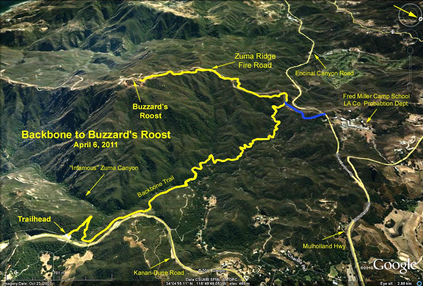
The Hike: From the trailhead the first portion of the hike goes northwest 2.5 miles on the Backbone Trail. The first half mile is a bit tricky, as there are several false trails. Stay on the most heavily used trails upslope from the creek (Zuma Creek). About 2 miles along the trail we pass Upper Zuma Falls which are usually dry. There is a poor trail over to the Falls with heavy poison oak undergrowth so it is not a recommended side trip.At 2.5 miles the Backbone Trail comes out on Zuma Ridge Trail, which, despite the name, is a graded fire road. We travel south up this moderately steep trail 1.4 miles to the top. This is a good place for lunch, with a sweeping view of the ocean from Catalina to Santa Cruz Island.
Do not take the side road that leads to the Buzzard Roost Ranch. It is private property.
The planned hike turns around here and returns the way we came. Those who want more mileage and altitude gain can continue along the fire road south toward the ocean before turning around. Alternatively, continue north on the fire road to Encinal Canyon Road. Refreshments will be at the trailhead.
Google Earth photo - Backbone Trail to Buzzard's Roost
GPS Data:
Basic Hike: 7.9 mi. RT; Max. elevation gain = 1035 ft. (Yellow trace)
Encinal Add-on: 0.7 mi. RT; 75 ft. elevation loss and gain. (Blue trace)