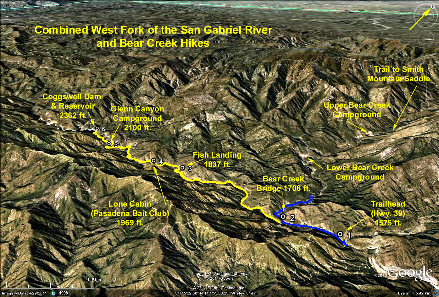
Distance: 16 miles round trip to the dam; 14 miles to Glen Canyon CG.
Elevation gain = 800 ft.
Directions to Trailhead: From the 210 Freeway go north on Route 39 about 11 1/2 miles above Azusa to mileage paddle 26.96. Park in the West Fork parking area on the left.
The hike: There are two options: Bike or hike up the West Fork of the San Gabriel River the whole way to Cogswell Dam on the paved road, or boulder bound up Bear Creek to explore Bear Canyon.
Option 1: Hike or bike up the road as far as you wish, and return. The dam itself is a very interesting destination at 8 miles one way. Note that most of the elevation gain occurs within 1 mile of the dam.
Glen Canyon campground, 7 miles along the road, is another good place to eat lunch and turn back. Nearby are the remains of an old cabin - just some stone walls remain. A faint trail to the left leading out of the campground will take you to Glen Canyon Falls - a triple cascade which is spectacular in wet years. The upper cascade is bit difficult to see. At the end of the trail one must scramble up the bank on the right and peer through the trees.
Option 2: Hike up the road about 1 mile to a bridge that crosses the river and the nearby junction of Bear Creek. Make your way down below the bridge, and head north upstream along Bear Creek on a trail that meanders back and forth across the creek, so expect to get your boots wet. Go as far as you wish into Bear Canyon, and return.
Google Earth Photo West Fork SGR - Bear Creek Hikes
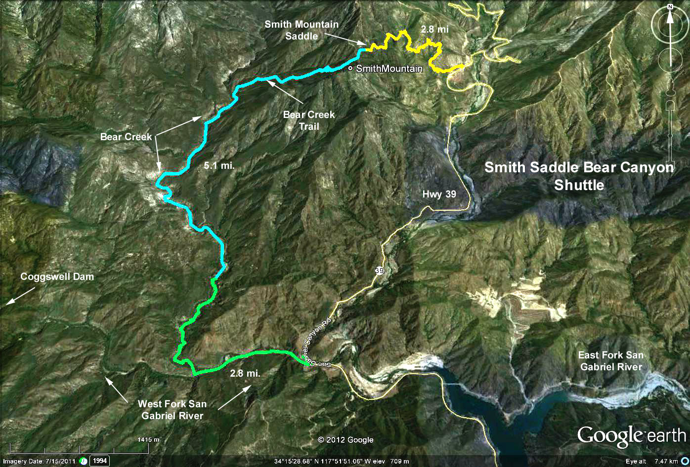
Google Earth Photo Smith Saddle - Bear Creek Shuttle
GPS Data:
RT to dam = 8.2 mi. Max Elevation change = 790 ft.
RT to Glen Canyon Campground = 7.1 mi. Max elevation change = 525 ft.
RT up Bear Creek (Blue Trace): 5.2 mi. RT; Elevation change = 300 ft.
One Way Shuttle Smith Mtn. Trailhead to Coggswell Trailhead = 10.5 mi., elevation change = 900 ft.