Trailhead Directions: Take the I-210 Freeway to the AZUSA off ramp. Turn left (north), Azusa Avenue will become San Gabriel Canyon Road and is also SR 39. Follow it up the mountain to the East Fork Bridge. Turn right onto the bridge, and continue past Williams Camp. It becomes a little tricky when you come to the intersection of the Glendora Mountain Road. Turn right and immediately turn left crossing the Glendora Road. Do not turn onto Glendora Mountain Road.
Continue to a white bridge and cross it, go up to the end of the road and park in the parking lot. There is a pit toilet there.
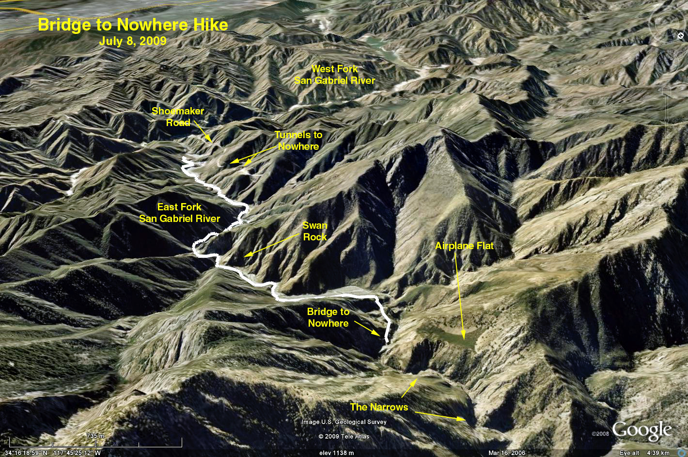
Bridge to Nowhere
Approximately 9 miles round trip
Elevation Gain: 1000 ft.
Hike past the locked gate to Heaton Flat. At Heaton Flat cross the river for the first of many crossings. Continue up-river past Swan Rock to the Narrows. Have lunch on the bridge and return to the cars. Be prepared to make at least 40 stream crossings, many may be more than knee deep.
Cattle Canyon
7 miles round trip
Elevation Gain 700 ft.
The trail starts under the white bridge (see above) on the east side. Again, we will get our feet wet, as there are 19 stream crossings - some knee deep, but the water is not too swift. The entire trail is rocky but not difficult. After about 3.5 miles there is a locked gate. The signs on the gate indicate that the ranch owners very sincerely do not want anyone to proceed further. Have lunch at the wide stream crossing and return the same way.
Google Earth photo - Bridge to Nowhere
GPS Data (Valid for Bridge to Nowhere)
RT = 9.6 mi.
Trailhead Elevation = 2046 ft.
Max Elevation Change = 750 ft.