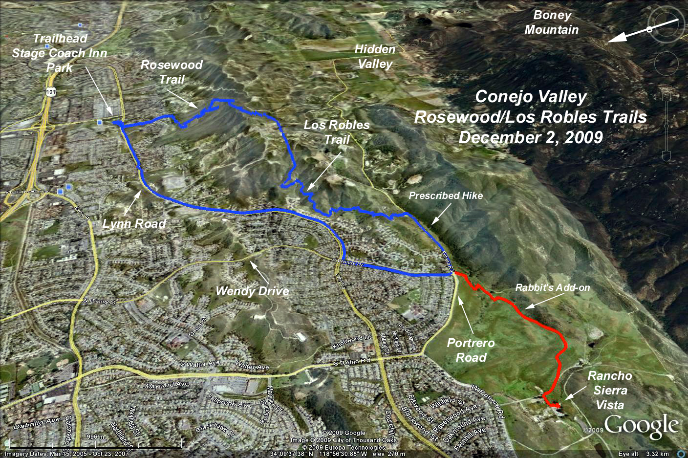
GPS Data:
Basic Hike RT = 8.0 mi.
Max elevation gain = 810 ft.
Add-on to Rancho Sierra Vista = 2.3 mi. RT
Directions to the trailhead: From the Ventura Freeway (101) in Newbury Park, exit Ventu Park Road and drive south. After about half a mile you'll notice the entrance to Stage Inn Museum, go a block further to Lynn Road and turn right (west). Then make another right on Susan Drive, which looks like a long driveway. And park along the edge of Stage Coach Inn Park. (You can walk through the park's back gate to the museum when is open). There are restrooms at the park.
The Hike: Carefully cross Lynn road and go right (west) to Rosewood Trail (about 138 yards). This is also a horse trail so watch your step. Going south, the path crosses a creek, passes homes and climbs some hills. The sights get better and better, culminating in the ridge-top views at Angel Vista Point a grandiose name for a little flat spot with a picnic table. For those desiring a shorter hike, turn around at this point and return to the trailhead (4 mi. RT, 800 ft. elevation change - yes, the bulk of the hike elevation gain is experienced in the first 2 miles).
Continue by joining signed Los Robles Trail heading west. The path continues across private land (courtesy of a trail easement) and meanders up and down the ridge until it reaches a parking area off Potrero Road at 4.2 miles. Here you can have lunch. There is a drinking water fountain, but no toilets.
You can return the same way you came, or go back via Potrero Road to Wendy Drive, to Lynn Road all the way to Susan Drive.
To extend the hike, cross Potrero and join the connector trail that leads west 0.5 mile to Rancho Sierra Vista/Satwiwa Park, and continue, 1 mile or so, to a Native American cultural center.
We will have our refreshments along the edge of Stagecoach Inn Park.