Distance: About 7 miles
Elevation gain: About 700 ft.
Directions:
From the North: South on the Harbor Freeway (SR-110) to its end at Gaffey Street, turn left onto Gaffey. Then right on W. 25th Street. Go about 2 miles to La Rotonda Drive, turn left and follow it downhill to the end. Turn right into the parking area. There is a public rest room.
From Palos Verdes: South on Hawthorne Blvd, then left on Palos Verdes Drive. South to La Rotonda Drive, then right to the parking area.
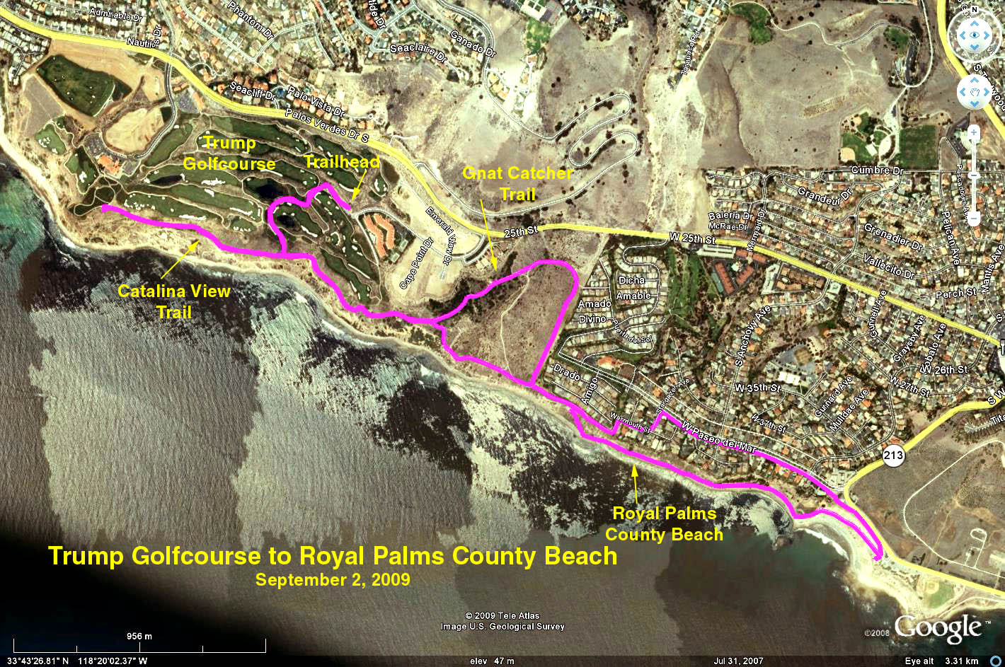
The hike: We start above the Trump International Golf Course with a good overview of the course. As we walk through the golf course area, there are gray concrete paths for hiking and peach tinted concrete paths for golf. Stay off of the peach paths. The trail follows the bluff above the Pacific and is identified as the Gnat Catcher Trail when it enters the Palos Verdes Shoreline Park.
There is an Andy Gump at the San Pedro city boundary. We then pass in front of a trailer park onto Warmouth Street, then Stargazer Avenue and along Paseo del Mar to Royal Palms County Beach for a cookie break.
We will retrace the path and continue along the bluff to picnic benches in front of the TIGC clubhouse for lunch. Notice along the way that there are three 'beach access trails'. The middle one is less steep than the others, so it will be easiest to go down. The other two are good for exercise when coming back up. After lunch, the rabbits may want to hike along the beach to The Portuguese Bend Club (about a 1 mile round trip).
There are some terrific vistas along the way, so consider bringing a camera and/or binoculars. A round of golf is only $195 on weekdays -- a bargain compared to $295 on Friday, Saturday, and Sunday. Supposedly, Trump has $167 M invested in this venture.
Google Earth photo - Trump Golf Course to Royal Palms Beach
GPS Data:
RT = 5.7 mi.
Max Elevation change = 311 ft.