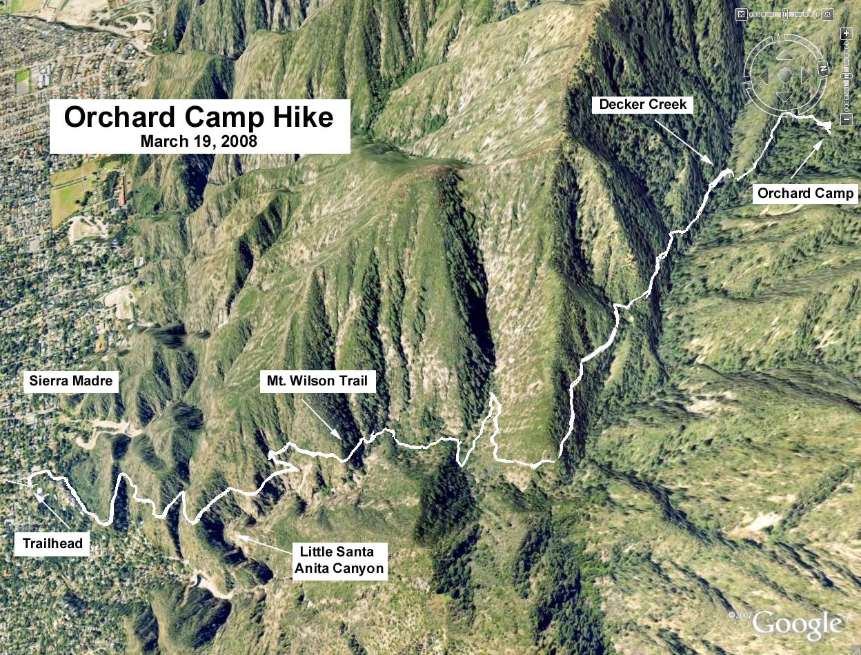
GPS Data (Basic Hike):
RT = 7.4 mi.
Max Elevation Change = 2350 ft.
History: According to "Trails of the Angeles," Orchard Camp was the site of the Halfway House since it was located halfway between Sierra Madre and Mt. Wilson. It was used as a construction camp for the Mt. Wilson Trail around 1864 the trail that was used to transport the materials for Harvards Mt. Wilson Observatory. Orchard Camp was closed in 1940 and only foundations remain.
Directions to Trailhead: Take the 210 Freeway to the Baldwin Avenue off ramp in Arcadia. For those coming from the east, the Baldwin Ave. off-ramp puts you directly on Baldwin Ave. going north. For those coming from the west, the off-ramp puts on Baldwin Ave. Turn left into the center lane of Baldwin Ave., continuing this way under the freeway bridge. At this point, Baldwin appears to end on Foothill Blvd. Turn left (there is a sign with an arrow) into the right lane of Foothill Blvd. and proceed (now going west), then turn right on the first street which is the continuation of Baldwin Ave. Proceed north on Baldwin to Mira Monte and turn right. Proceed to the trailhead at Mt. Wilson Drive. Park on the street around the Mira Monte Park where we will have refreshments after the hike. There is a restroom at the park.
The Basic Hike: The hike is straight up 3.5 miles to Orchard Camp on the Mount Wilson Trail and back down.
Option 1: First Water. This is not a loop hike and there are many places along the trail to stop and turn around. The first scenic spot is at about 1.5 miles where the trail splits. The main trail goes to the left and a trail to the right drops down to a beautiful streamside location.
Option 2: Alternate route to Orchard Camp. At the streamside from Option 1 continue on the trail along the stream. That trail is usually not in good condition. In about one half mile after a steep climb it rejoins the main trail. This option is better used coming back from Orchard Camp.
Option 3: Last Water. To add another mile and 850 feet elevation gain continue up the Mount Wilson Trail out of Orchard Camp. The trail climbs steadily and then descends in the final approach to the creek and the canyon bottom.
Option 4: Mount Wilson. Continue with option 3 to trail's end at Mt. Wilson - approx. 14 miles total RT from the trailhead, max. elevation about 4000 ft.
Google Earth photo - Orchard Camp via Mount Wilson Trail
Please see Dans Hiking Pages for some history and trail hints.