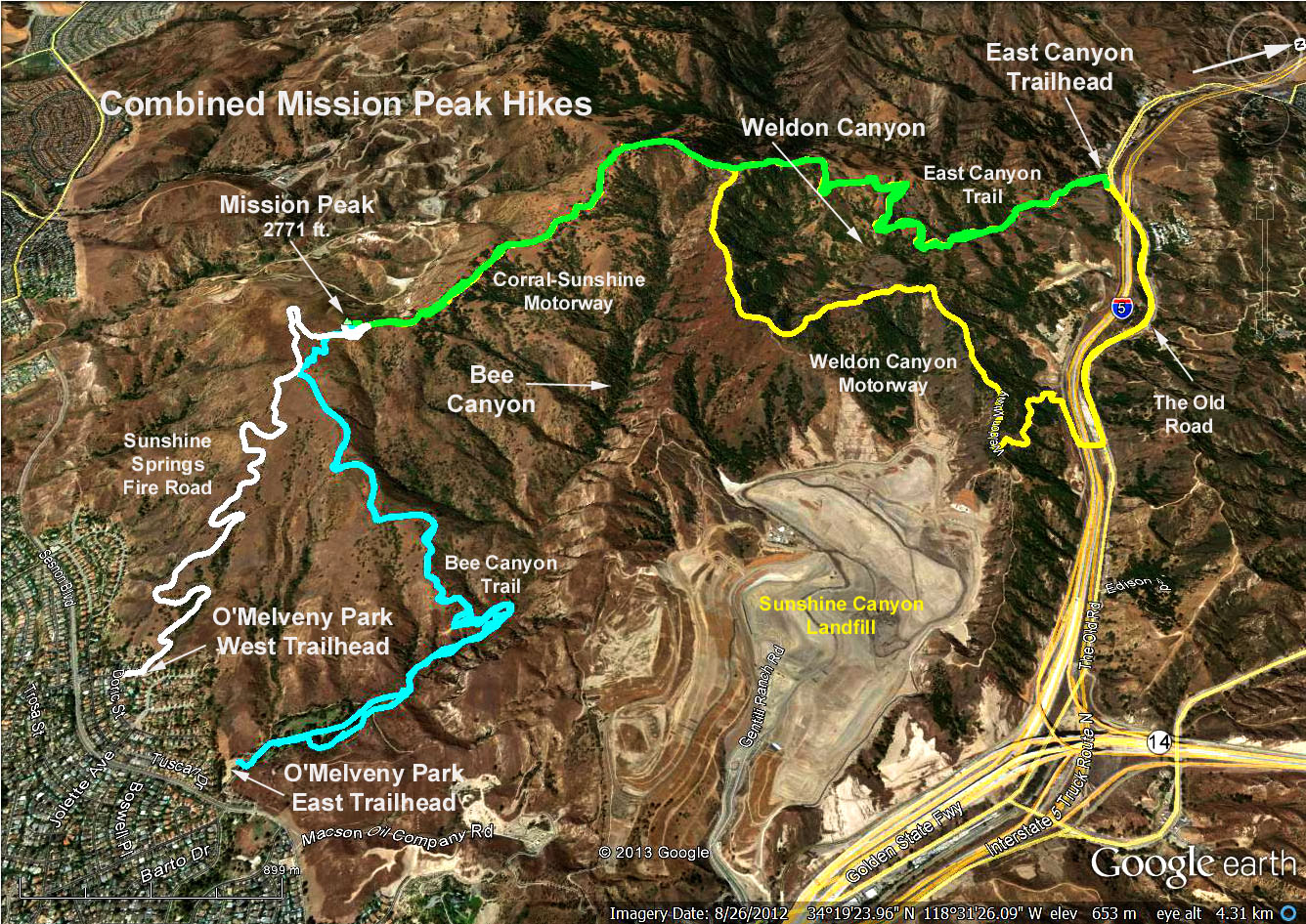
GPS Data:
Basic Hike: 5.4 mi. RT, 1270 ft. max. elevation change.
Alternate Hike: 5.2 mi RT, 1250 ft. max. elevation change.
Summary: There are two ways to reach Mission Peak - each with its own trailhead. The basic hike traverses the lower portion Bee Canyon, then climbs its western ridge reaching the peak mostly on trails. The alternate hike starts from a trailhead farther west in the park and attains the peak via a fire road.
Directions to the Trailhead: Go west on the 118 freeway. Exit at Balboa and head north. After 2.3 miles, turn at Sesnon Blvd. and drive 0.6 mile to O'Melveney Park entrance on the right. Restrooms are in the park approx. 100 yds. from the parking lot.
Alternate Trailhead: Continue as above on Sesnon Blvd, past Jollette to Neon Way, turn right and park at end of Neon Way.
The Basic Hike: From the parking lot walk through the park on the paved road, which becomes a dirt trail leading into Bee Canyon. The trail crosses the stream a few times and after about 1 mile, Mission Point Trail branches off to the left. Continue up this trail eventually reaching a fire road crossed by a large iron gate which breaks a long iron fence. Look to the right, and follow a switch-backed trail up to the peak. Return the same way.
Alternate Hike: Proceed up Sulphur Spring Fire Road until reaching a large iron gate. Proceed to the peak as per above. Return the same way.
Notes: The trails past the park are not maintained and are steep in some places. There are some rain damaged areas but all are passable. The poison oak is growing well in Bee Canyon and be aware of ticks and other bugs in this area. Long pants and shirts and/or bug spray are recommended.
Refreshments will be served in the parking lot.