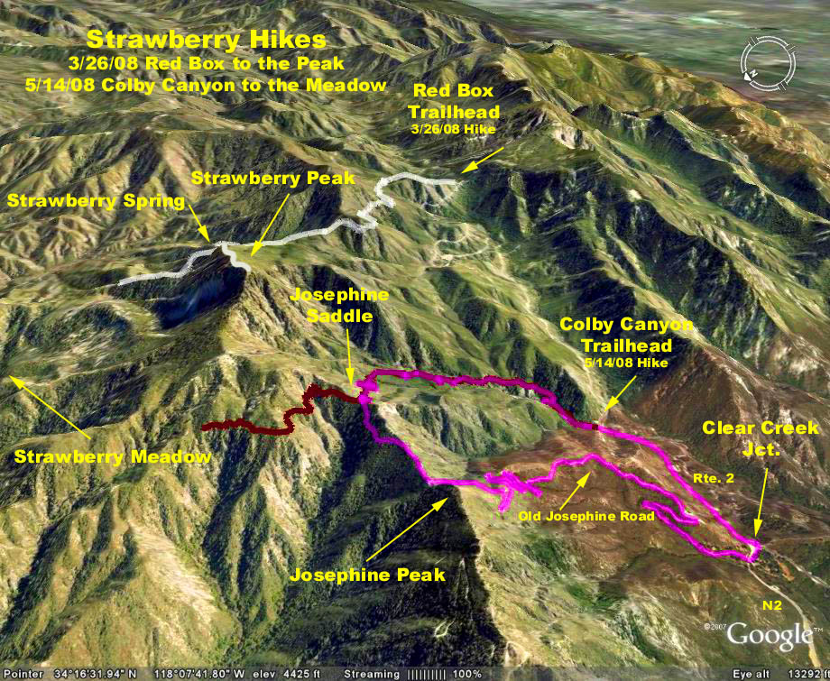
Trailhead Directons: Take Angeles Crest Highway 2 to Clear Creek Junction (the junction of Angeles Crest with Angeles Forest Highway - N3) and park across the street from Clear Creek Ranger Station on Angeles Forest Hwy.
The Hike: We start up the Josephine Fire Road eventually reaching Josephine Saddle. At this point we choose an option:1. Turn around at the saddle (4800 ft.) and return the way you came for a 4.8 mile RT / 1300ft. trip.
2. Cross the saddle and take the Colby Canyon Trail south back to the highway at the Colby Canyon trailhead, then walk a mile back to the cars on the highway. About 6.2 miles RT / 1500 ft.
3. Turn left and go on to Josephine Peak (5558 ft.), retrace back to the saddle, then continue per Option 2 for a trip of 8 miles RT / 1,900 ft.
Note: The waterfalls close to the road at Colby Canyon trailhead are wonderful. Be sure to pause and enjoy their beauty.
Google Earth photo - Colby Canyon & Josephine Peak
GPS Data for Option 2 Clear Creek, Josephine Saddle, Colby Canyon, Route 2 (magenta trace):
RT = 6.0 mi.
Trailhead = 3493 ft.
Max Elevation Change = 1485 ft.