GPS Data:
7.6 mi. RT, elevation gain = 1300 ft.
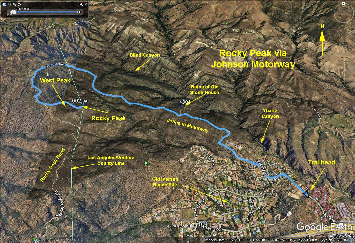
Directions to Trailhead: Take the 118 Freeway to Topanga Canyon Blvd., make a right turn off the freeway and then left onto Poema Place. Valley hikers make a left onto Poema Place from the end of Topanga Canyon Blvd. Drive up Poema Place to the entrance of Indian Wells residential area. Park on the street east of the double yellow street line. (The yellow center line portion of the road is private property and parking on this portion of the road is prohibited). No restroom facilities are available.
The Hike: Enter the residential area on the left side of the entrance gate. Follow the green line painted on the left side of road until you reach a stop sign. Cross the street at the green painted crosswalk and follow the green line up the hill (Macoda Lane) and onto the entrance of the trail (do not follow green line that goes to the left at this point since it is coming from the other entrance). The green line marks the route for hikers to traverse this gated community, an easment that was required from the builder in order to complete the development. It is about 1 mile from the gate to the trail entrance.
Once on the trail keep left and continue upwards on a degraded road. At 2.1 miles you will reach Rocky Peak Road, turn left and continue south on Rocky Peak Road. After 0.75 mi look for a use trail that leads off to the left over and around a small peak (West Peak) (See Detail of Rocky Peak Access Trail). Only after getting around West Peak can Rocky Peak be seen. Continue on the trail down onto a saddle between the two peaks then proceed to scramble up the rocks to Rocky Peak. We return to the trailhead the way we came.
For those wanting a shorter hike, you may turn araound at any point.
2017-05-22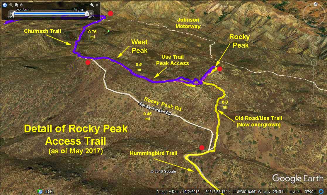