Distance: 7 miles RT
Elevation gain: 500 ft.
Directions to Trailhead: Take the Ventura Freeway (US 101) to Liberty Canyon Road and go south about 0.8 miles and you will see a black iron fence and gate across the road. Park on Liberty Canyon Road. Liberty Canyon Road is the second exit west of Las Virgenes (Malibu Canyon Road) so people coming from the south area might want to use PCH.
The Hike: Covers six trails. We start by going south on the Phantom Trail leading us to Mulholland Hwy. We cross Mulholland and pick up the Cistern Trail which leads us up slope to a junction with the Lookout Trail at the top of the ridge overlooking Malibu State Park. We turn to our left and take the Lookout trail over the ridge and down to the High Road where we turn left and follow the High Road almost to the park parking lot. Eventually, we see the Grassland Trail on our left leading north up out of the canyon. Turning left again, we proceed along the Grassland Trail across Mulholland Hwy. until it joins the Liberty Canyon Trail which we take back to the Trailhead.
Being a loop, those wanting a shorter hike should go as far as they wish, turn around and go back to the trailhead the way they came.
Google Earth photo - Malibu State Park via Liberty Canyon
GPS Data: RT = 7.1 miles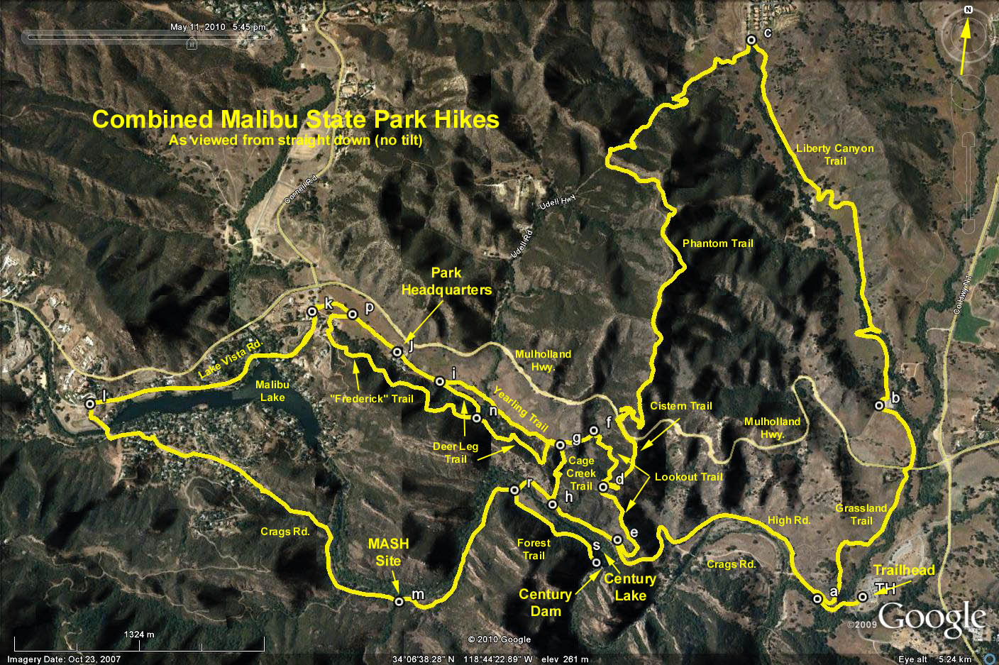