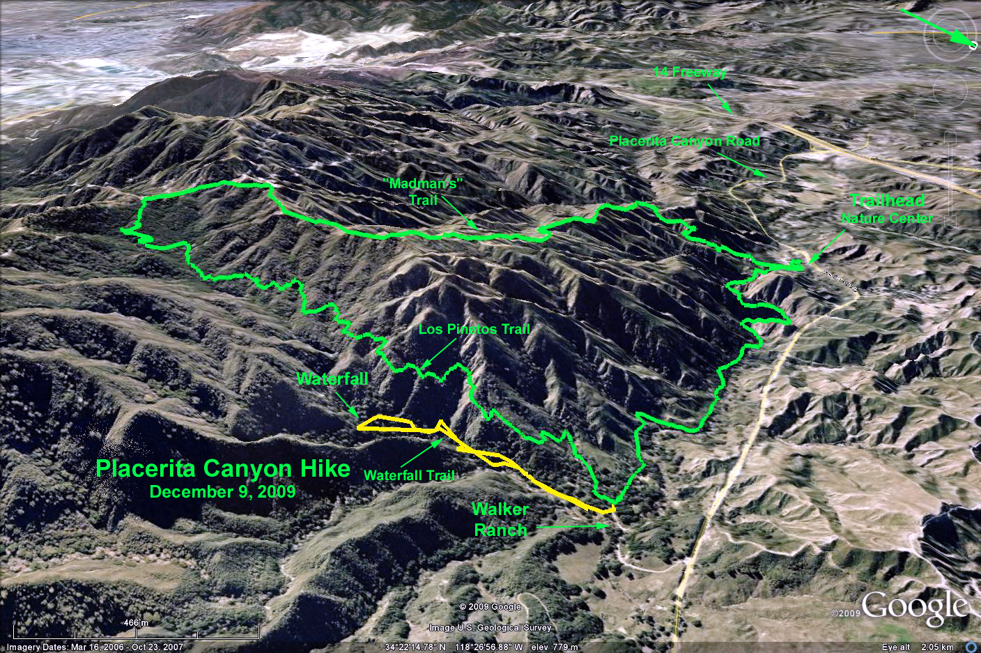
GPS Data:
Mild = 4.2 mi. RT, 350 ft. elevation gain
Moderate = 9.0 mi. RT, 1800 ft. elevation gain
Difficult = 7.3 mi. RT, 1800 ft. elevation gain
Waterfall = 1.2 mi. RT, 700 ft. elevation gain
Summary: There are three hike options: Mild, moderate and difficult, and an optional add-on side trip to the waterfall, which can be done from any of the basic hikes.
Directions to the Trailhead: Take the 5 to the 14 North. At about 3 miles on Hwy 14, take the Placerita Canyon off-ramp and turn right (east). At about 1.5 miles, the entrance to the Placerita Canyon Nature Center is on the right. Park in the main parking lot.
The Hike: All hikes start at the Nature Center.
Mild hike walks the excellent and lovely trail upstream to Walker Ranch and returns the same way. May also hike the waterfall trail, which starts at Walker Ranch.Moderate hike: Walk the same trail upstream as above to Walker Ranch, then turn up the Los Pinetos Trail to the road at the top. Return the same way. This is a very pretty hike for the entire length. You may also add on the waterfall trail if you have time. CAUTION: You DO NOT want to turn right at the top of the Los Pinetos trail and return on the Manzanita Mountain trail (The reverse of the Difficult hike) as you will be hiking downhill on close to 2 miles of loose, steep decomposed granite slopes.
Difficult hike: Start at the Nature Center parking lot and walk up the Manzanita Mountain trail (you'll be going in the opposite direction from the above hikes). This trail is quite steep and follows the ridgeline up to a road at the top. The scenery is lush chaparral at the bottom, giving way very soon to low scrub and grassland. At the top, turn left on the road and hike about ¼ mile until you come to a restroom. Immediately turn left and continue down the Los Pinetos trail to Walker Ranch and return to the Nature Center down the main trail along the stream. You may also add on the waterfall trail if you have time.
Waterfall trail: This trail starts at Walker Ranch very close to the Los Pinetos trailhead.
Refreshments across the stream from the nature Center.