Distance: Outer Loop 10 mi. RT, and 1150 ft. elevation change.
Inner Loop 4.5 mi. RT, and 800 ft. elevaton change
Direction to Trailhead: The Sycamore Canyon parking lot is reached by driving about 20 miles west of the Malibu Canyon Road on Pacific Coast Highway.
The Hike:
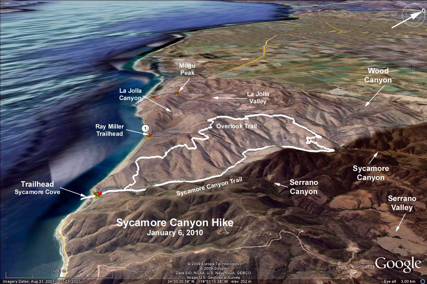
Outer Loop: Walk through the campground and upstream on the Big Sycamore Canyon Trail. Continue on the trail, passing the Overlook Trail on the left in about half a mile and the Fireline Trail on the left in about one mile and the Serrano Canyon Trail on the right in about 1.3 miles.
Continue on the Big Sycamore Canyon Trail for another 2 miles to the junction of the Backbone Trail where you turn left. At the Overlook Trail junction (after another two miles) you turn left again. You follow the Overlook Trail all the way (almost 4 miles) to the Scenic Trail and turn left. The Scenic Trail leads you back to the Big Sycamore Canyon Trail where you turn right and return to the trailhead.
Inner loop: Proceed as above except turn left at the Fireline trail and continue up the hill to the junction with the Overlook Fire Road Trail. Turn left and proceed to the Scenic Trail junction where you turn left and continue as above. Note: The inner loop can be extended by turning right instead of left on the Overlook Fire Road and continuing along it as far as you wish. Return to the Fireline Trail junction, and continue back to the trailhead as above.
Google Earth photo - Sycamore Canyon Overlook Trail Loop
GPS Data
Outer Loop: RT = 9.6 mi., 1110 ft. max. elevation change.
Inner Loop: RT = 4.4 mi., 785 ft. max. elevation change.
Extended Inner Loop (see "7 Mile Point" on Google Earth photo): RT: 7 mi., 1050 ft.