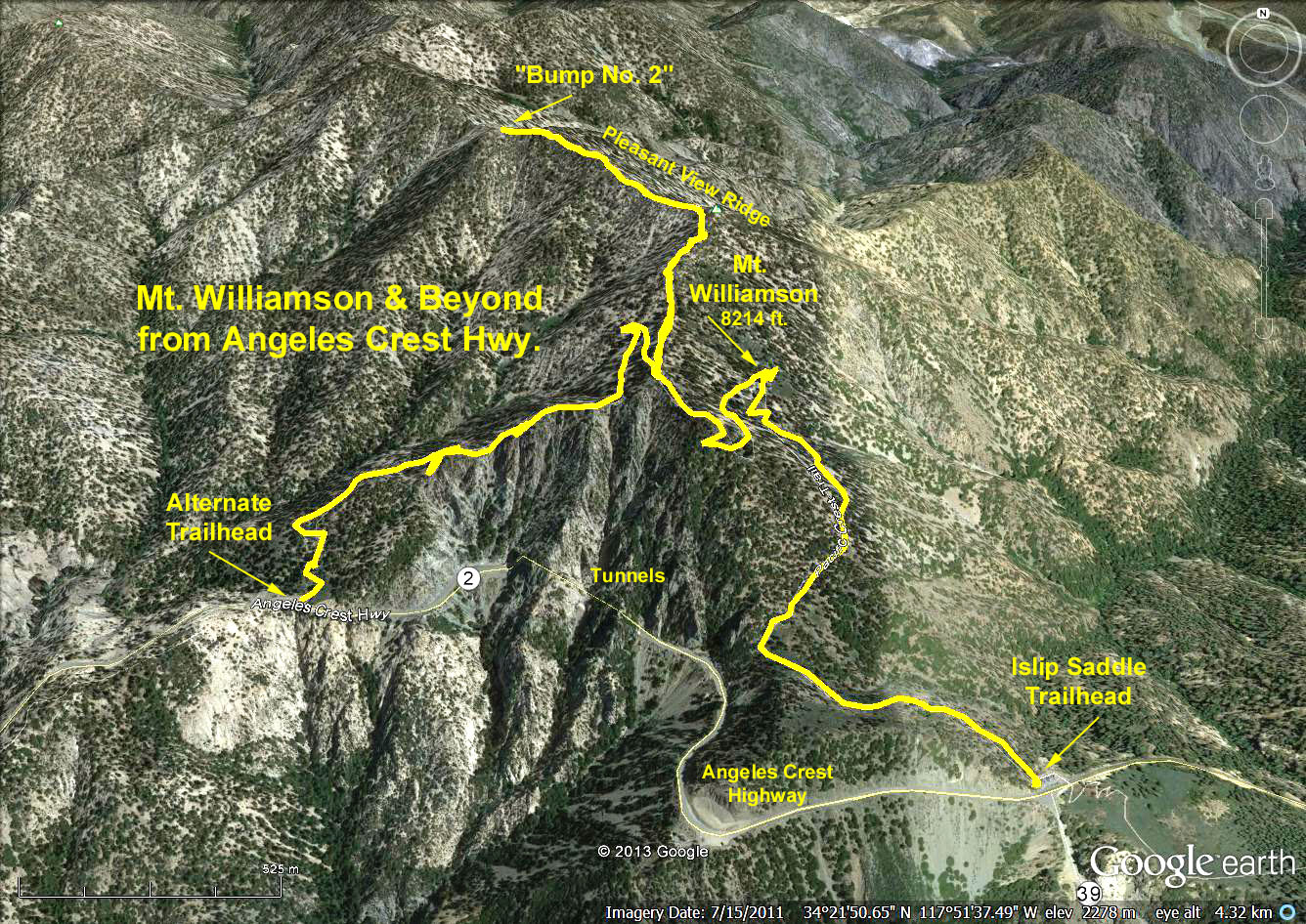
Directions to Trailhead: Islip Saddle, on Highway 2, at mile marker 64.1, at 6660 feet. There are pit toilets and some shade.
Basic Hike: Hike to the summit of 8214 feet Mount Williamson, approximately 4+ miles RT and 1600 feet elevation gain.
Pleasant View Ridge Options:
To "Bumps 1 and 2" (Bump 2 has been our usual lunch spot). From the summit of Williamson, head out NW along the Pleasant View Ridge. Hike out to bumps #1 and 2 at 8244 feet and 8248 feet. Going to Bump 2 adds approximately 1 mile RT and 200 feet elevation gain.
To the "Sharp Bend". The 1/2 mile beyond Bump 2 is a steep 300 feet down and then 160 feet up to an 8160 foot bump. Next is a 200-foot drop, and then the trail takes a sharp bend to the west. Adds approximately a 660 foot elevation gain.
To the 7760 foot Pallet Mountain. Beyond the "Sharp Bend" is a 600-foot drop. Then, it is about 3/4 mile up to the summit of Pallett. Note: Pallet is 2 1/2 miles from the summit of Mt. Williamson, adding 5 miles to the basic hike and a heck of a lot of up.
In all cases, return to Islip Saddle for Refreshments.
Google Earth photo - Islip Saddle to Mt. Williamson and Pleasant View Ridge
GPS Data: NOTE: Includes data for an alternative trailhead located before the tunnels on Angeles Crest Hwy.
One way Islip Saddle to Bump 2 = 2.8 mi.
Max Elevation change = 1585 ft.
One way Alternate Trailhead to Bump 2 = 2.5 mi.
Max Elevation change = 1524 ft.