Distance: 7 miles RT
Elevation loss: 750 ft.
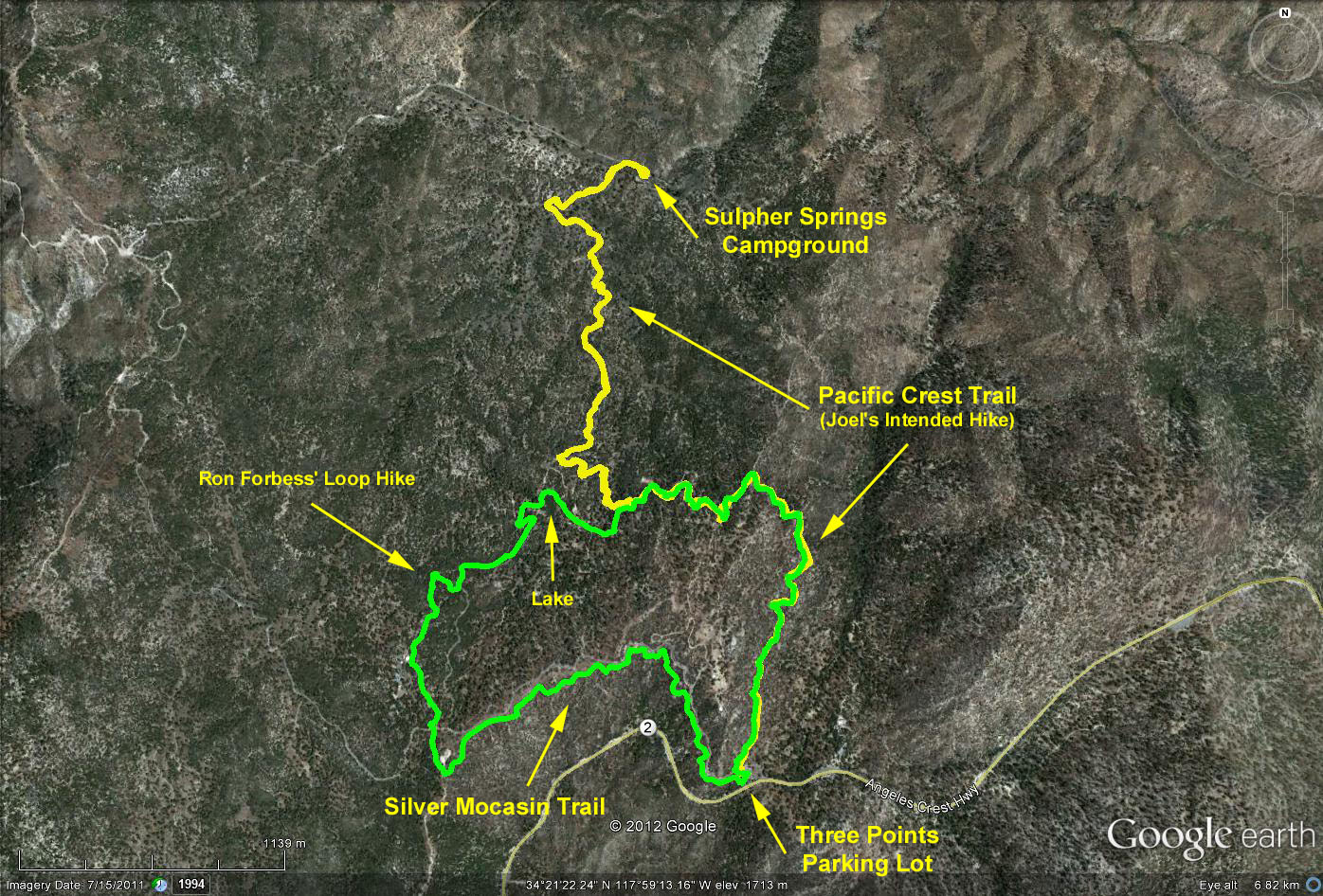
Trailhead Directions: Drive north on Hwy 2 (Angeles Crest) from the 210 freeway past the Clear Creek Information Center to Sulphur Springs Road (3N17) which is about 2.5 miles past the Chilao Visitor Center turnoff. Turn left and proceed about 100' to the paved parking lot and park. There is a restroom at the parking lot.
The Hike: We proceed northerly on the Pacific Crest Trail (starts uphill out of the parking lot opposite the entrance). The route descends through oak, manzanita and open chapperal. Bear right at the junction of the trail and the extension of the road out of Singing Pines Camp and continue north until reaching Sulpher Springs Road. Turn right and proceed into the campground for lunch. Return the same way.
Those hikers desiring a shorter hike can turn around whenever they wish.
Hikers should be aware that the Silver Mocasin Trail intersects the PCT adjacent to the parking lot. An alternate hike would be to follow the Silver Mocasin Trail west 3.0 mi. to Horse Flats campground.
Google Earth photo - Three Points to Sulpher Springs Campground
GPS Data:
RT = 7.5 mi.
Max elevation change = 760 ft.