Distance: Basic Hike = 6.5 miles RT with 1500 ft. elevation gain.
Longer Hike to Verdugo Peak = adds 3.5 miles RT and 470 ft. elevation gain.
Trailhead Directions: From the I-210 freeway, exit at Ocean View Blvd. Turn south until it turns into Verdugo Road, continue, and at the Y bear right onto Canada Blvd. After about 0.2 miles, make a sharp right at the country club sign onto Country Club Drive. (This is in Glendale, not to be confused with the Country Club Drive in Burbank). Turn left onto Beaudry Boulevard and follow it to where it changes to Beaudry Terrace. Park on the street.
From the SR-2 freeway exit at Mountain Street in Glendale, turn west and go to Verdugo Road. Turn right (north) on Verdugo and at the Y bear left onto Canada Blvd. and follow the instructions above.
The Hike: We start up the fire road alongside a debris basin. At 0.4 miles the road forks into Beaudry South and Beaudry North. We'll take the north road up (not as steep!). At 2.3 miles the two roads meet again, we continue on Verdugo Fire Road about 1/2 mile to have lunch.
After lunch, we return by taking the same road back to the fork and go right on Beaudry South. About 3/4 miles down the road is a Y, going left is the shorter way back.
For those of you who want a longer hike you can go up to Verdugo Peak and back.
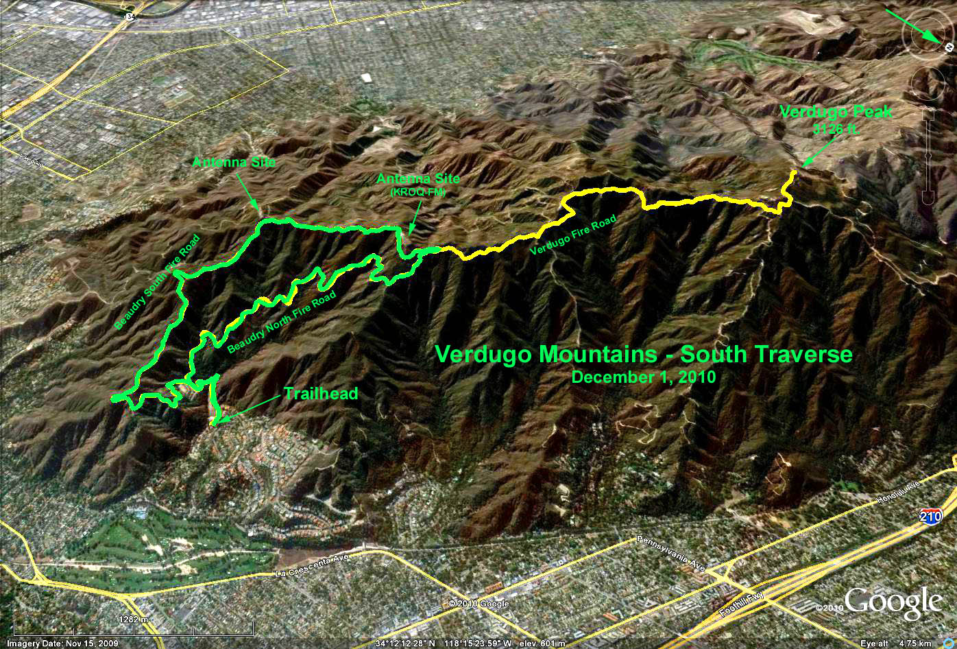
Google Earth photo - South Traverse of the Verdugo Mountains
GPS Data
RT Basic Hike = 5.7 mi. (Green Trace)
Max Elevation = 1450 ft.
RT Verdugo Peak add-on = 4.6 mi. (Yellow Trace)
Elevation Delta = 636 ft.