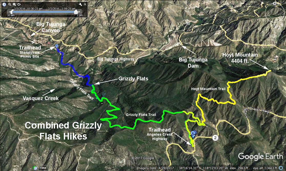
Distance: 8 mile round trip
Elevation: 1,550 feet total gain
Trailhead Directions: Drive to Grizzly Flat Road (2N79) on Angeles Crest Hwy. SR-2. Park in the large lot on the left opposite mileage paddle 30.64.
The Hike: We will climb about 0.6 mile and 300 ft. on 2N79 to the beginning of the Hoyt Mountain Trail, a poorly maintained dirt utility company road that takes off of the Grizzly Flat Trail to the right. We will climb an additional 550 ft. to a utility tower*. At this point a steep trail can be seen leading off to the right that climbs another 505 ft. to the top of Hoyt Mountain.
*Be sure to avoid taking another trail leading away from the base of the utility tower that goes around the north side of Hoyt Mountain and continues on into Big Tujunga Canyon.
Return to the trailhead the way you came.
Google Earth - Combined Grizzly Flat (Yellow Trace)
2017-07-27