Distance: 7.5 miles
Elevation gain: 2450 ft.
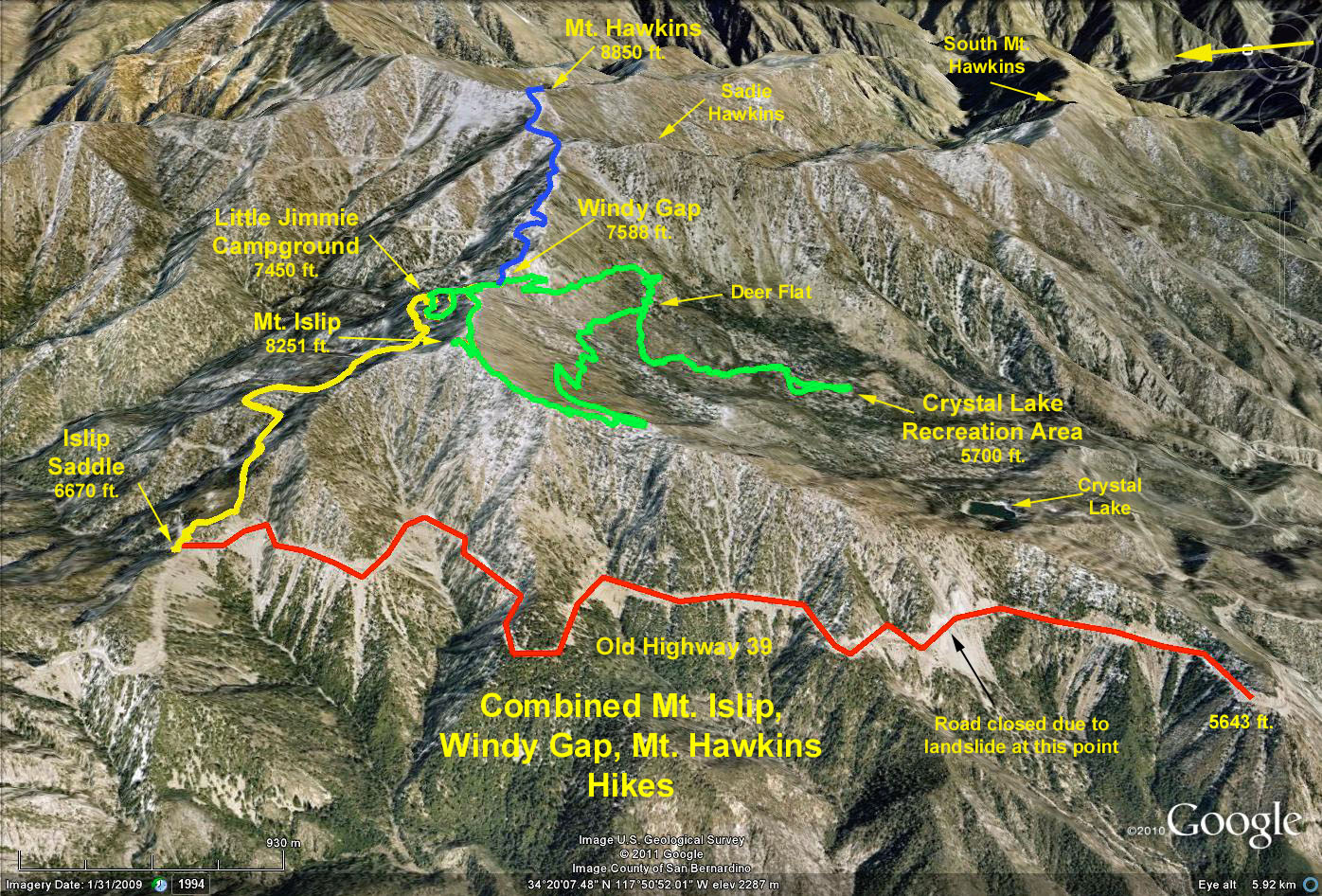
The Hike: From the parking lot, follow the Windy Gap trail 1.3 miles to a fork in the trail. During this stretch you will cross the Mt. Hawkins Truck Trail twice. Take the right fork, which is marked "WINDY GAP." The 1.4 mile climb is fairly steep, and arrives at Windy Gap, a low point on the Pacific Crest Trail, with panoramic views north to the Mojave, and south toward Crystal Lake and Azusa and beyond.
From Windy Gap, follow signs to Mt. Islip (not the PCT). The actual trail to Mt. Islip is a short spur that takes off from the trail after about 0.8 miles of steady climbing from Windy Gap.
After Mt. Islip, continue on the descending trail southward. At 0.9 miles, make a sharp left turn on the trail marked Big Cienega, which after 1.8 miles returns you to the Windy Gap trail. Turn right, and continue down to the parking area.
Point of Interest: Just South of Mt. Islip, as you begin your descent, you come into an area of banded gneiss rocks which are ancient (pre-Paleozoic, or >550 million years). This metamorphic rock shows wonderful black and white banded patterns, often in swirls. Sometime during the Mesozoic, (around 200 million years ago), this rock was intruded by molten magma, which solidified into granite. There are many lines of contact visible where the granitic magma solidified in contact with the gneiss.These areas were the actual walls of the magma chamber--usually 2 - 3 miles deep in the earth. These lines are recognizable as abrupt transitions from the bland grey-pink granite to the strongly patterned gneiss. As the magma was intruded under tremendous pressure, there was a lot of fracturing of the gneiss, and many chunks of the gneiss fell off the chamber wall into to granitic magma. These chunks are visible all along the trail today as "xenoliths" (foreign rock [Greek]) or patches of banded gneiss embedded in the patternless granite.
Google Earth Photo - Mt. Islip from Crystal Lake Recreation Area