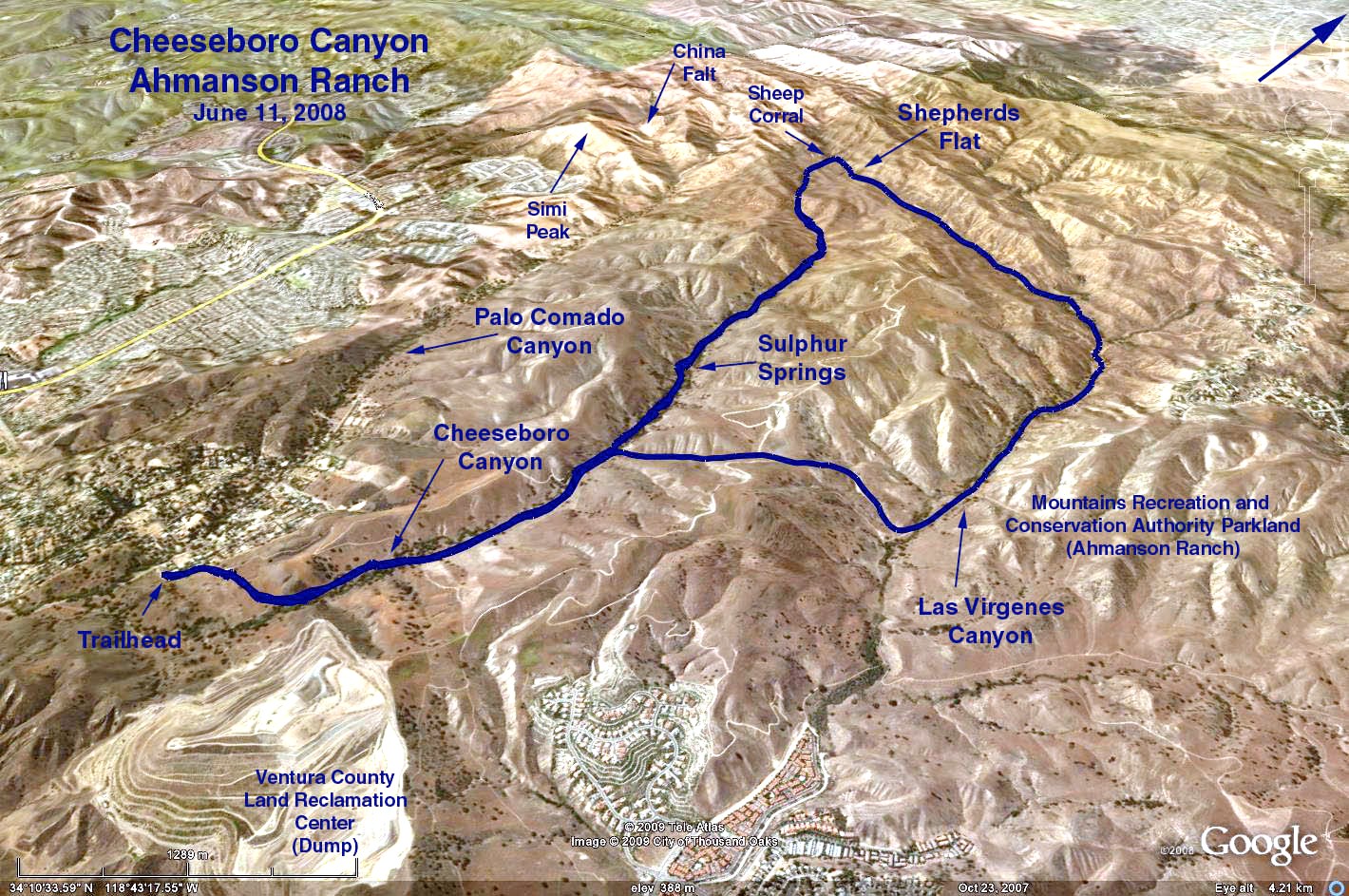
Distance: Approximately 9 mi. RT
Elevation gain: 500 ft.
Directions to Trailhead: Go west on the Ventura (Hwy 101) Freeway from the San Diego (405) Freeway or from the Las Virgenes (Malibu Canyon) Road. Exit at Cheeseboro Road, and go right. At the bottom turn right and follow the narrow road (be alert for hidden oncoming traffic) to the entrance to the park. Follow park road back to the parking lot (don't park at the entrance lot.) Toilets are available at the parking lot.
The Hike: We follow the Modello Trial up-and-over to the Las Virgenes/Cheeseboro Ridge Trail to the top of the ridge. We will take the Ridge trail and follow the ranch road down to Shepherd's Flat. Lunch under the big oak nearby (toward the Sheep Corral). Return to the parking lot via Sheep Corral Trail/Sulfur Springs Trail/Cheeseboro Trail.
NOTE: Hike is easy going except for the Modello Trail and the Cheeseboro Ridge/Las Virgenes Trail. Park is very dry and even the stream is dried up but we enjoyed the company of lots of birds and some wild flowers. There is no poison oak unless one gets off the trails, most of the trails are old ranch roads.
Original 2001-06-27 Hike 569 Description
Google Earth photo - Cheesborough Canyon
GPS Data:
RT = 10.1 mi.
Max Elevation = 450 ft.
2017-07-02