Distance: 12.5 miles round trip
Elevation Gain: 2200 ft.
Legend says that Mount Pacifico was named "Pacifico" by the bandit Tiburcio Vasquez, because he could see the Pacific Ocean from the top. No doubt the air was a lot clearer in the 1870s.
Directions to the Trailhead: From 210 freeway: Go approx. 10.5 miles on Angeles Crest Hwy to the Clear Creek junction with Angeles Forest Hwy. Turn left on Angeles Forest Hwy. and go approx. 14 miles to mile paddle 10.37 at Mill Creek Summit. From the San Fernando Valley: Take Big Tujunga Canyon Rd. to Angeles Forest Hwy junction. Turn left and go approx. 11 miles to Mill Creek Summit. The trail starts just east of the parking/picnic area at Mill Creek Summit (elevation 4990 ft.).
The Hike: A scenic hike, mostly on the Pacific Crest Trail except for a "scramble" for the last 500 vertical feet up the west ridge to the summit. Tables and restrooms are available at the summit campground.
Two alternate hikes are suggested: Hike the PCT as far as you wish and return the same way - or - continue to the junction with the Mt. Pacifico road, and return via the road.
Refreshments at the Trailhead
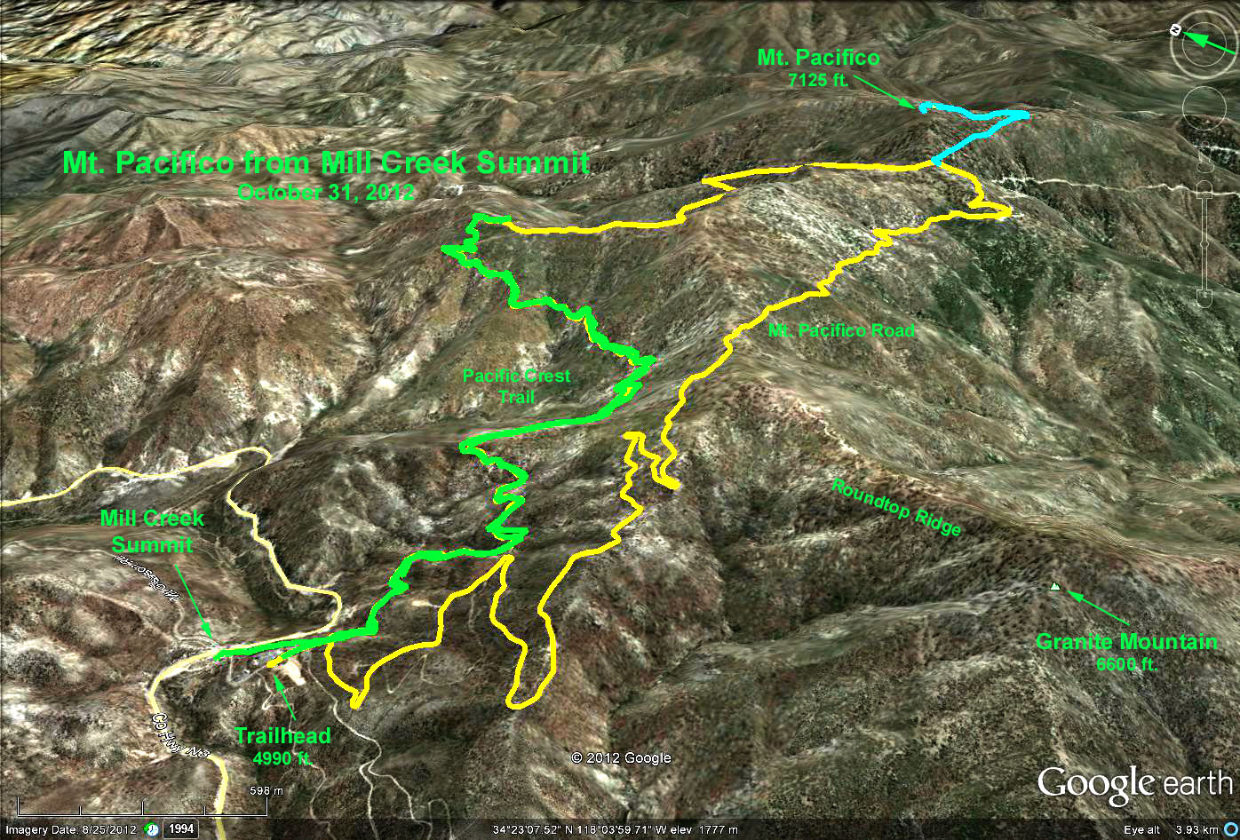
Google Earth Photo Mt. Pacifico from Mill Creek Summit
GPS Data:
PCT Trail only (Green Trace): 7.2 mi. RT; max. elevation change = 1300 ft.
PCT Trail, return via road (Yellow Trace): 10.5 mi. RT; max. elevation change = 1675 ft.
Add-on to peak (Cyan Trace): 2 mi. RT; and 460 ft. for a total of 12.5 mi. RT with max elevation change = 2135 ft.