Orange County Hike
Weir Canyon Loop
November 18, 2020
Meet at 9:00 am
GPS Data:
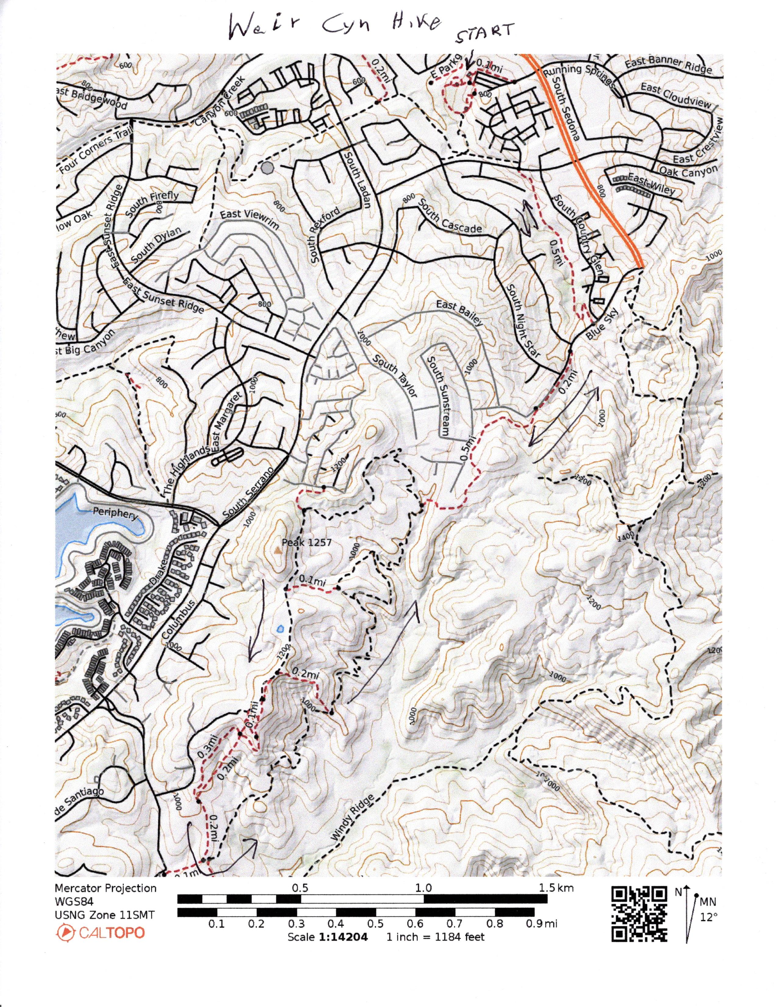
7.5 miles RT. 1,300 feet elevation gain.
Directions to Trailhead: Exit the 91 freeway at Weir Canyon south. Continue to Running Springs Drive and turn right into the Ronald Reagan Park. Park at the west side of the parking lot.
The Hike: The red dashed circle at the start of the hike represents a walking path within the park. Follow the dashed trails on the map south in the direction indicated by arrows drawn on the map. Shortly after you make the left turn after you leave the park you will pass through a tunnel. Continue south and follow the arrows around the loop. If you do the whole loop the distance is 7.5 miles, 1300 ft elevation gain.
There are two short-cut trails that cut off part of the loop for a shorter hike. The second one is steep and difficult to locate. If you do the loop all the way to the end, be sure to watch for the confusing trail signs. For an even shorter hike, turn around sooner.Map: Weir Canyon Loop
Updated: 2020-11-19