West Valley Hike
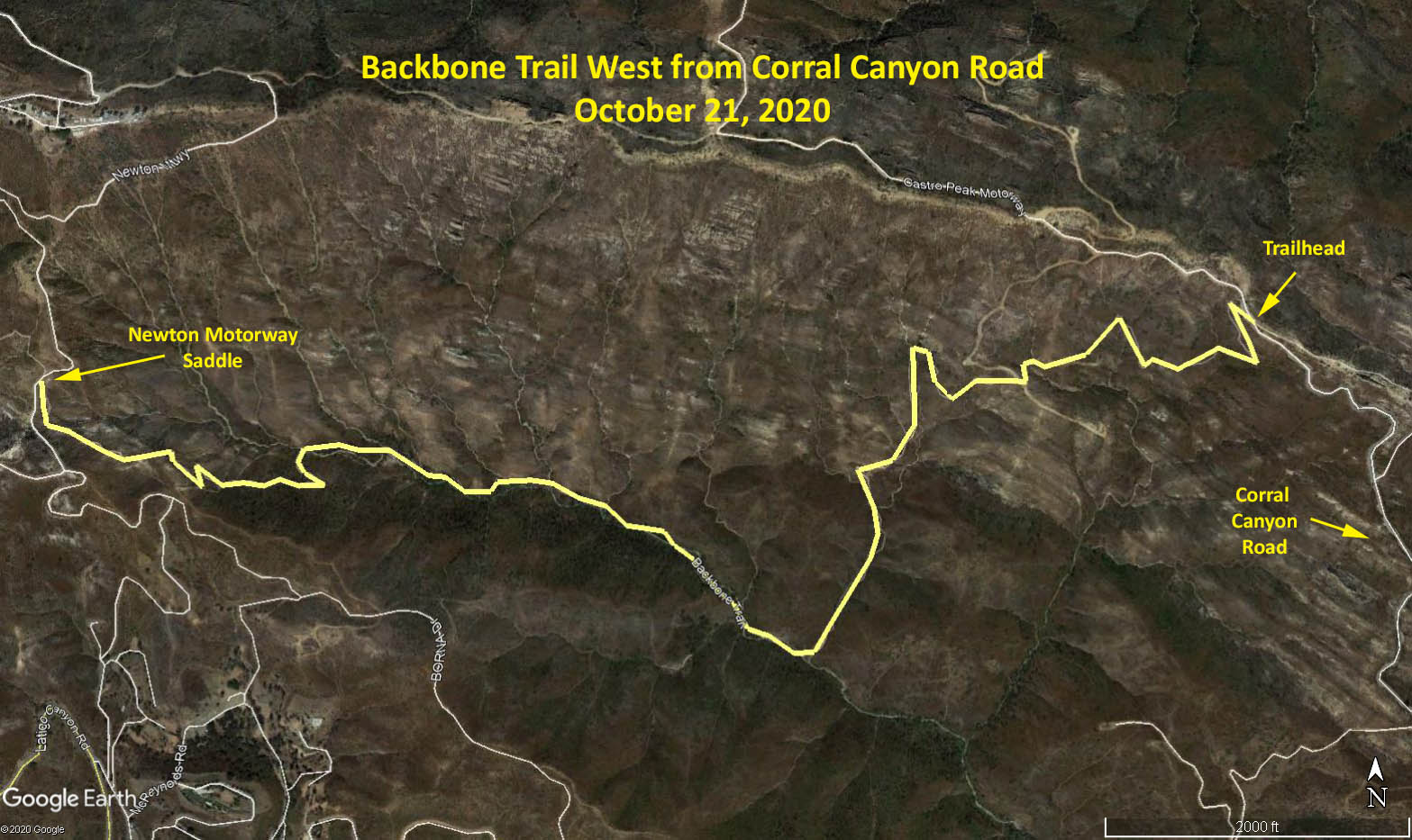
Backbone Trail West from Corral Canyon Road
November 4, 2020
Meet at 8:00 am
GPS Data:
Basic: 5.33 miles RT.
Additional options 1.25 RT
600 feet elevation gain.
Directions: Head west on the 101. Turn left at Las Virgenes Canyon Road. Turn right on Pacific Coast Highway. After 2.4 miles, turn right onto Corral Canyon Road. Drive 5.5 miles until the road turns to gravel. Continue another 0.1 miles to the dirt parking lot on the left. There is no parking fee and no restrooms.
General: The hike is mostly in the Upper Solstice Canyon and is the longest stretch of riparian woodlands on the entire Backbone Trail, with plenty of shade and creek crossings.
Hike: Locate the trailhead at the west end of the parking lot, that is signed “Backbone Trail, Corral Canyon Trailhead.” Take the single-track trail.
At 0.45 miles the single-track trail joins a gravel road. Turn right. After a minute, the road joins another dirt road in a T junction. Continue straight, on the single-track trail.
At 0.72 miles, the trail crosses a stream. A seasonal 20-foot waterfall lies just upstream to the right.
At 2.5 miles, the trail becomes steep, rocky, and slippery at a large slab of blue/grey sandstone. Turn right at the T-junction.
At 2.67 miles, you reach Newton Motorway, a saddle between Castro Peak and Little Castro Peak (aka Obert Peak). Turn around and return to the trailhead. An option is to turn left and climb clockwise around to the top of Little Castro Peak for an additional 0.5-mile RT.
Upon returning to the Corral Canyon trailhead, a further option is to continue east along the Backbone Trail to some nearby impressive rock formations. 0.75 miles RT.
Google Photo Map: Backbone West from Corral Canyon Road
The hike description is abstracted from “The Complete Hiker’s Guide to The Backbone Trail”, by Doug and Caroline Chamberlin.