Hike #1564
Mandeville Canyon to San Vicente Missile Site
March 27, 2024
Hike Leader: John Leete
Meet at 9:00 am for start at 9:30 am.
Rabbits will start at a time to be determined.
Please print your own hike descriptions and maps.
Directions to Trailhead: Take the 405 freeway to Sunset Blvd. exit, proceed west on Sunset Blvd. about 3.2 miles to Mandeville Canyon Road. Turn right at the traffic light and go to the first stop sign, then left onto Westridge Road. Proceed to the end of Westridge Road which is the trailhead for the Mandeville Fire Road. There is limited parking in the trailhead parking lot (space for 10 cars). This hiking trail is popular with local dog owners, so the trailhead parking gets full early. There is plenty of overflow parking on Westridge Road north of Cordelia Road. Also, take care parking at the trailhead as the dirt lot is heavily rutted and low clearance cars can easily bottom out. There are no restrooms or picnic tables at the trailhead, so please bring chairs.
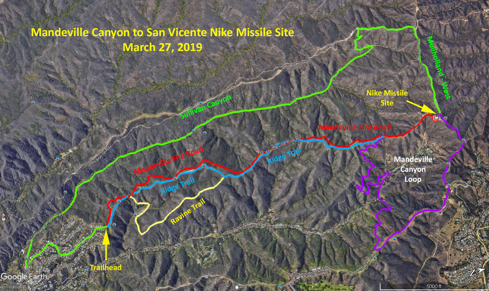
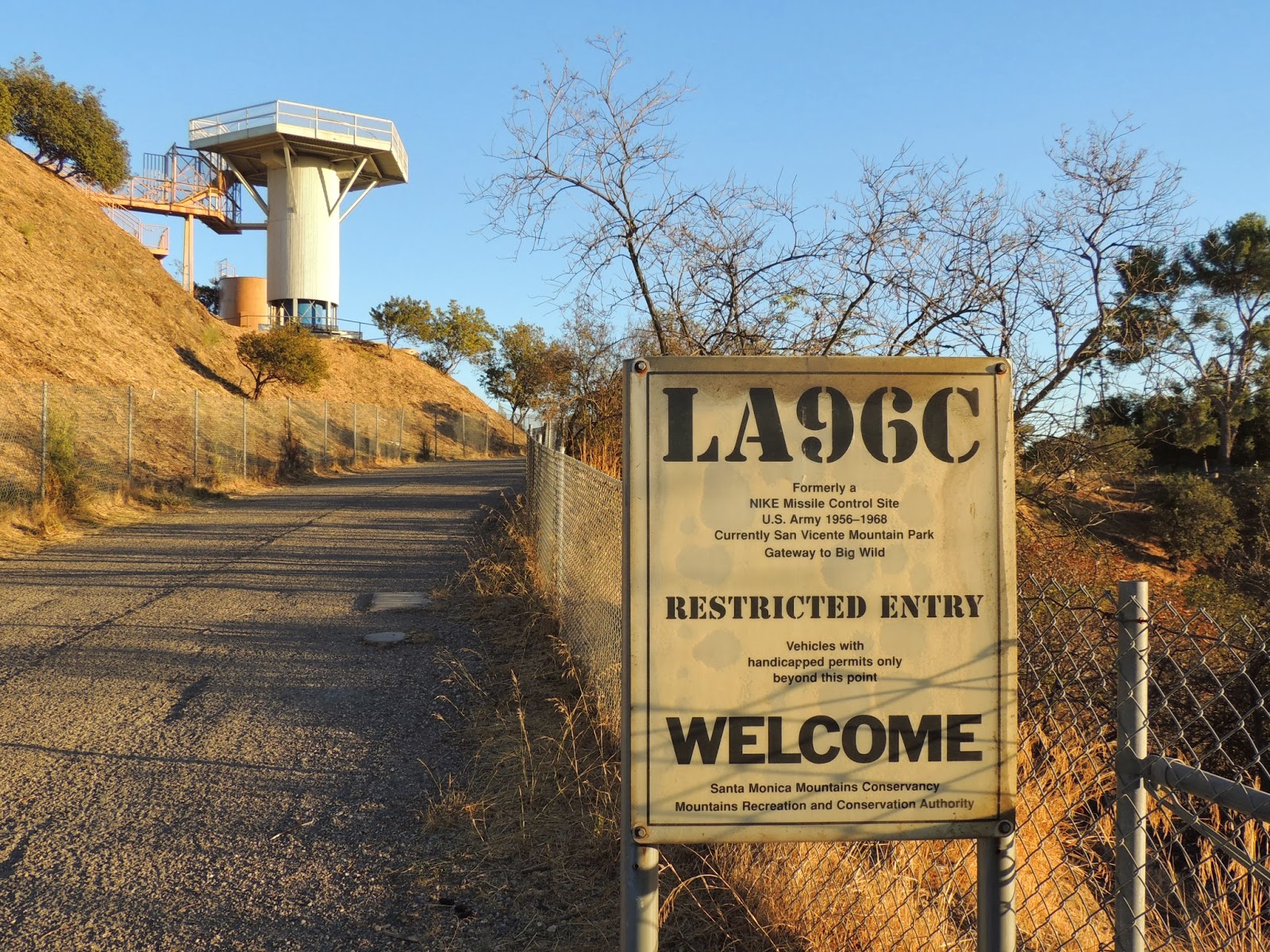
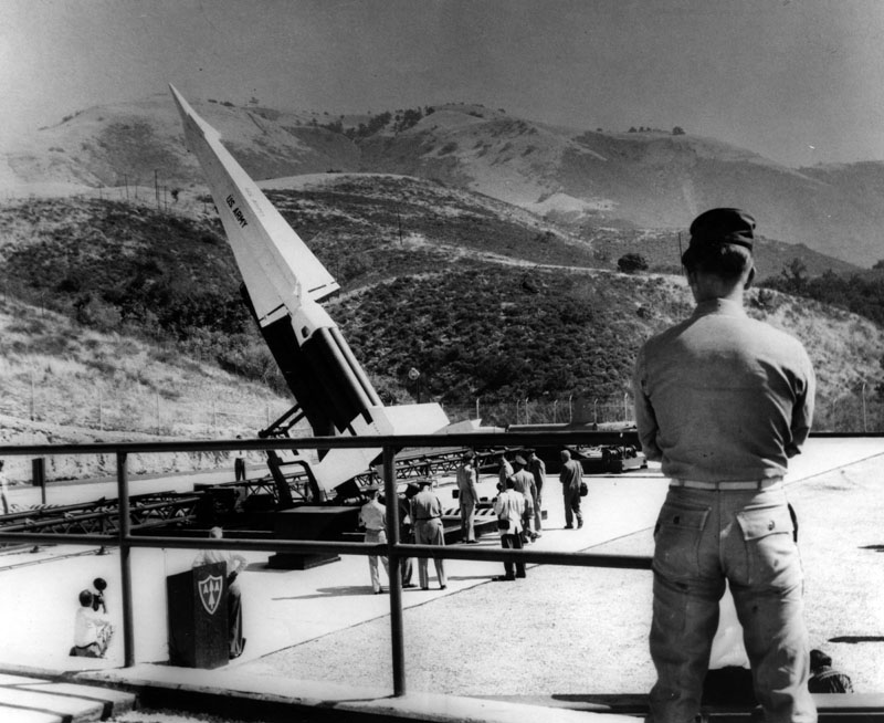
Basic Hike - Fire Road - Red Trail: Take the Mandeville Fire Road at the left of the parking area which leads to a Nike Missile Radar Site that is on the Mulholland Fire Road. The Mandeville Fire Road is partially in the sun and partially in the shade. Tables and restrooms are available at the Nike site so this is a good place for lunch. Make sure you climb to the top of the observation tower for 360 degree views of the SF Valley, downtown, westside and the ocean. Return by the same fire road or alternate hike #1.
Alternate Hike #1 - Ridge Trail - Blue Trail: There is a ridge trail that parallels the fire road to the right (east) for almost the entire length of the fire road. Access this trail from the right of the parking area. One can switch from fire road to ridge trail and vice versa at several location along its length. This ridge trail is approximately the same distance to the Nike site as the fire road but has many more ups and downs for more elevation change. An option would be to take the fire road up and the ridge trail on the return trip. The ridge trail affords much better views of the LA basin but is in full sun.
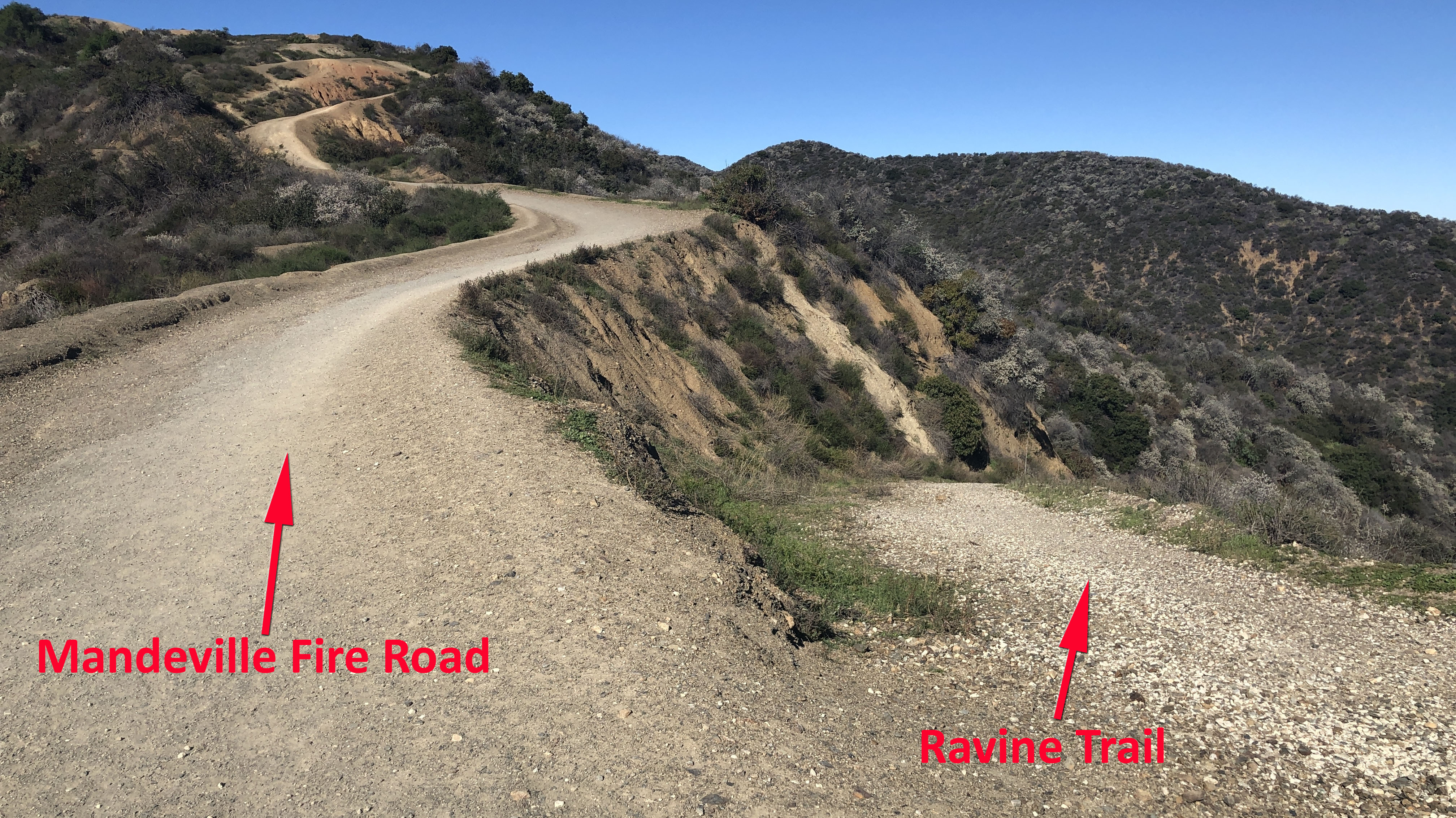
Alternate Hike #2 - Ravine Trail - Yellow Trail: Whether taking the fire road or ridge trail, after 0.4 mile, look for a trail on the right heading down into a ravine. This is identified on the map in yellow as the Ravine Trail, however it is not signed. Crossing the ravine and regaining the opposite ridge at about 1 mile from the trailhead there is a junction with a road turning sharply to the right that goes down into Mandeville Canyon - stay to your left on the trail eventually regaining the fire road in another 1.5 miles (may require some bushwhacking).
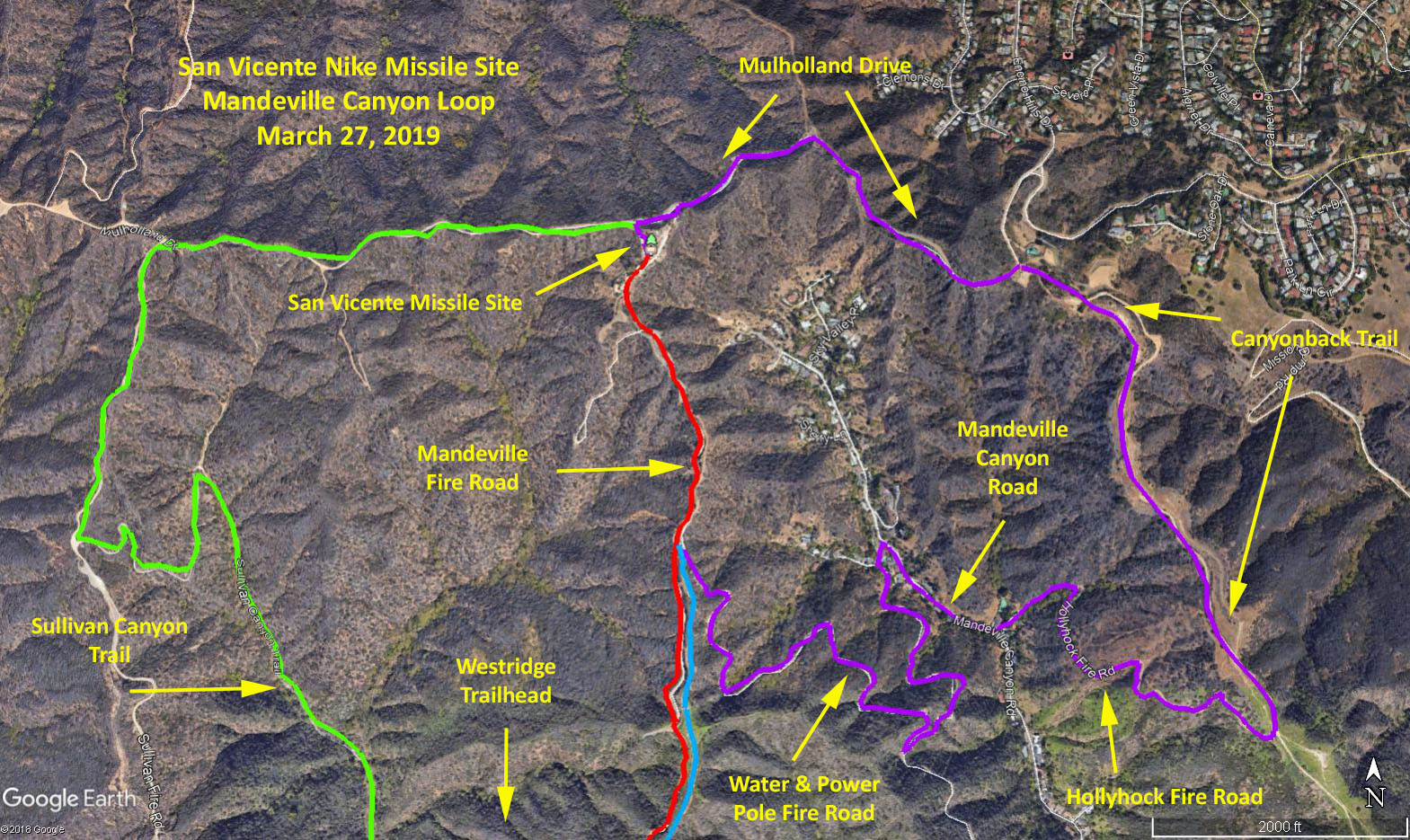
Alternate #3 - Mandeville Canyon Loop - Purple Trail: This option is an additional 4.25 mile loop to the basic hike. From the Nike site, head down to Mullholland Drive, turn right and go to the end of the dirt road (0.8 mile). At the parking lot, turn right onto the Canyonback Trail. After 1.0 mile look for a small duck and turn a sharp right, go though a metal gate onto the Hollyhock Fire Road. After 0.7 mile downhill, turn right onto Mandeville Canyon Road. After 0.25 mile, turn left onto Garden Land Road. After 100 yards, turn left onto Water and Power Pole Road. After 1.4 mile uphill, turn left onto the Mandeville Fire Road and return to the trailhead by the fire road (Basic Hike) or the ridge trail (Alternate hike #1).
Alternate Hike #4 - Sullivan Canyon - Green Trail: Take the missile site access road down to Mulholland, and continue west on Mulholland until reaching the west ridge of Sullivan Canyon. Descend into the canyon and take it south down canyon 5.6 mi. to the Queensferry Road trailhead (look for a large house up on the hill to your left with large statues of animals on the hillside). Continue south on Queensferry Road until it intersects with Westridge Road, turn left, and return to the trailhead.
Google Earth Photo - Mandeville Canyon to San Vicente Nike Missile Site
Google Earth Photo - Detail of Mandeville Canyon Loop
Park Entrance
Nike Missile
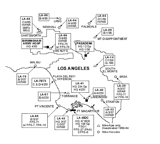
LA Nike Perimeter
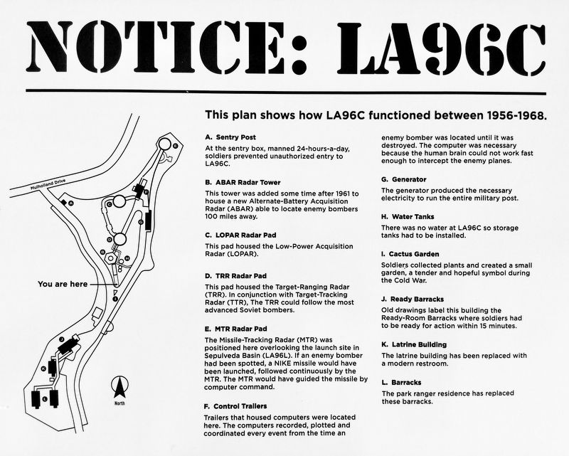
Site Plan
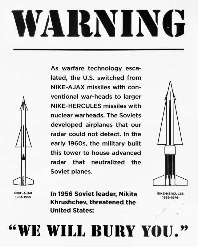
Warning
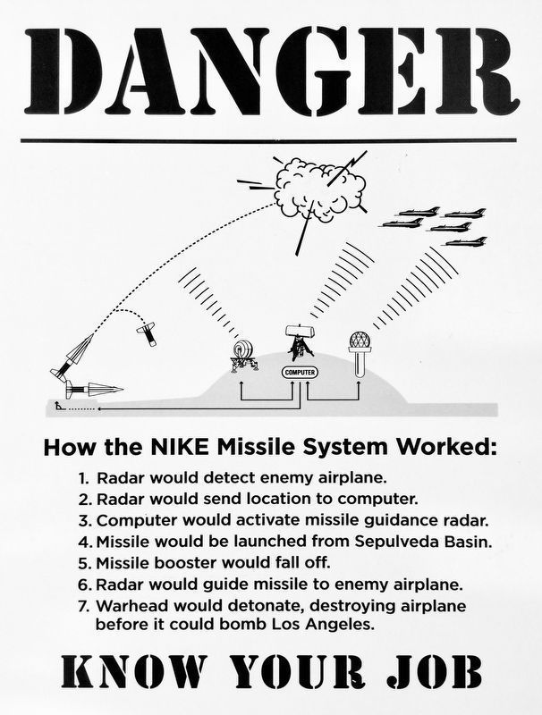
Danger
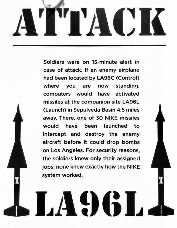
Attack
GPS Data:
Basic Hike - Fire Road - Red Trail: 7.0 mi. RT; max. elevation change = 675 ft.
Alternate Hike #1 - Ridge Trail - Blue Trail: 7.0 mi. RT; max. elevation change = approx. 1000 ft.
Alternate Hike #2: - Ravine Trail - Yellow Trail: Adds 0.5 mi. to the 3.5 mi. one way to the missile site. Adds a 450 ft. loss and gain to the basic hike elevation change.
Alternate Hike #3 - Mandeville Canyon Loop - Purple Trail: Additional 4.25 mi. loop. Total 10.8 mi. RT; max. elevation change 1980 ft. RT.
Alternate Hike #4 - Sullivan Canyon - Green Trail: 11.4 mi. RT; max. elevation change = 1300 ft.
Updated: 2024-03-06