Hike #1562
Mishe Mokwa / Backbone Trails to Sandstone Peak
March 13, 2024
Hike Leader: Niamh Anderson
Meet at 9:00 am for start at 9:30 am.
Rabbits will start at a time to be determined.
Please print your own hike descriptions and maps.
Distance: 7 miles RT.; Elevation gain: 1100 ft.
Directions to Trailhead: Enter Sandstone Peak Trailhead Parking Lot into your GPS. From the San Fernando Valley, take the 101 and exit at Westlake Blvd (Hwy 23) in Thousand Oaks. Turn left under the freeway and head southwest on Hwy 23. Turn right on Mullhollaand Hwy. Then turn right on Little Sycaaore Canyon Road. This road will change its name to Yerba Buena Road after passing the LA County / Ventura County line. Enter Sandstone Peak Trailhead Parking Lot on the right. There is a restroom at the parking lot.
Coming west on PCH, turn right at Yerba Buena Road and go north. At 5 miles, you will pass the Circle X Ranch ranger station (restrooms available). Approximately 1 mile further north past Circle X Ranch, turn left into the Sandstone Peak Trailhead Parking Lot (a sign, on the left, denotes this just past the lot entrance). There is a restroom available at the parking lot.
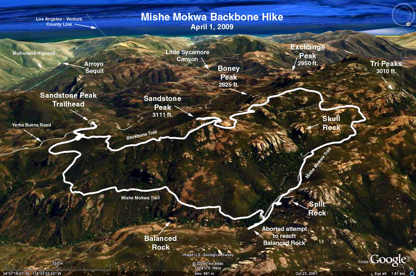
The Hike: Take the Backbone Trail (a fire road) uphill to the north. At 0.3 miles, leave the road and take the signed Mishe Mokwa Connector Trail straight ahead. Continue 0.2 miles to a junction with the Mishe Mokwa Trail and take the left fork. The trail contours along Boney Mountain on the western edge of Carlisle Canyon.
At 1.4 miles, Balanced Rock can be seen on the opposite right side of the canyon. Try shouting and listening for the echo. Descend into the canyon shaded by laurel, oak and sycamore trees to Split Rock and the picnic area. Take the trail across the stream, heading out of the canyon to another stream crossing by sculptured volcanic rocks. Parallel the stream (very little water) to a signed junction. Take the left fork -- the Backbone Trail -- curving uphill towards Inspiration Point. A short side path leads up to the overlook. Might be a good lunch spot since this is the only place there are rocks to sit down on.
Continue east on the Backbone Trail to another junction. This side trail switchbacks up to the 360-degree views at Sandstone Peak. Sandstone Peak is the highest point in the Santa Monica Mountains. It overlooks the Pacific Ocean, the Channel Islands, and the surrounding mountains. From the junction, it is 0.8 miles downhill back to the Mishe Mokwa Junction, completing the loop.
For extra mileage, explore the Tripeaks area. It's marked on the Google map below.
Instead of doing the loop counter-clockwise, the loop can also be taken clockwise, doing Sandstone Peak first, followed by the Mishe Mokwa Trail..
NPS Circle X Ranch Brochure and Trail Map - Mishe Mockwa Trail / Backbone Trail / Sandstone Peak
Google Earth photo - Mishe Mocka/Backbone Trails - Sandstone Peak
Updated: 2024-03-06