Hike #1547
Devil's Canyon
October 18, 2023
Hike Leader: Sonia Sahyouni
Meet at 8:00 am for start at 8:30 am.
Rabbits will start at a time to be determined.
Please print your own hike descriptions and maps.
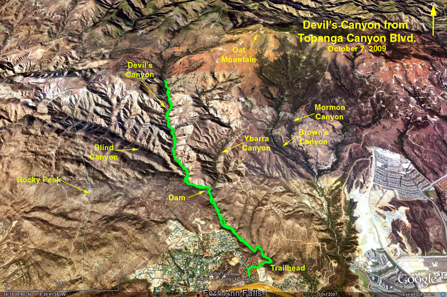
GPS Data:
RT = up to 10 miles
Elevation Gain = approx 600 ft.
Directions to the Trailhead: Go west on Hwy 118 and exit on Topanga Canyon Blvd. At the end of the off-ramp, take a sharp right turn onto Poema Place. Go several hundred yards to a cross-walk. Park on either side of the street. The trailhead is a horsetrail on the north side of the street, next to the cross-walk. For those from the West Valley, go north on Topanga Canyon Blvd. Go underneth the 118 freeway and turn right on Poema Place. There are no restrooms or picnic tables at the trailhead
The Hike: Go along the horsetrail up a slight rise. Take the left fork and travel along the east and north side of the condo complex. The trail will bend to the right and then to the left in a generally northerly direction. The trail is generally shaded with a slight elevation rise. In about 2.5 miles one comes to a dam. Follow the trail for as far as you want to go. Prior OTP hikers have gone as far as 5 miles before turning around for a 10 mile RT.
Google Earth Photo - Devil's Canyon
Updated: 2023-10-04