Hike #1516
Grizzly Flat from Angeles Crest Highway
January 25, 2023
Hike Leader: Dan Bergstrom
Meet at 9:00 am for start at 9:30 am
Please print your own hike descriptions and maps.
GPS Data:
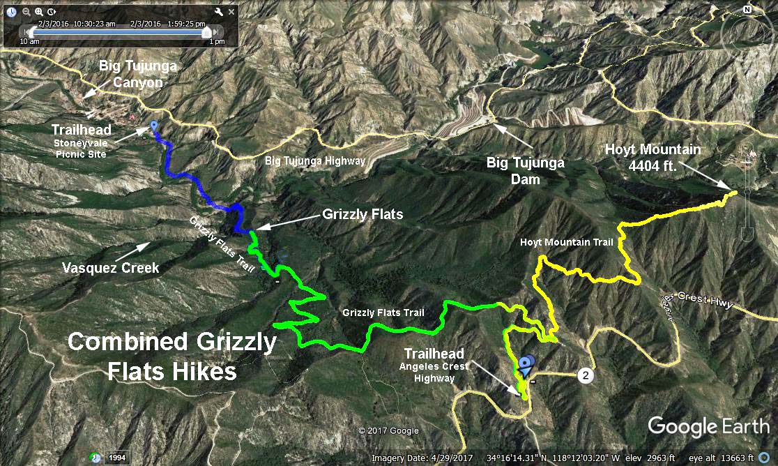
RT = 6.7 miles
Elevation gain/loss = 1,760 ft.
Trailhead Directions: From the 210 Freeway drive north on Angeles Crest Hwy (Hwy 2) for 6.2 miles to a parking area on the left (north) side of the road at mileage paddle 30.64.
The Hike: Climb some 450 ft. in the first mile, then descend 1,300 ft. to Grizzly Flat and beyond. Along the way we will have an excellent view of Tujunga Canyon as we descend the escape route used by Tiburcio Vasquez in his early raids on the ranchers of Los Angeles. Return the same way.
Grizzly Flat sits on the crest of the divide between the Arroyo Seco and Big Tujunga watersheds amid a grove of pines planted by the Forest Service after a fire in 1958. A faint, unmarked trail goes off to the right to Vasquez Creek in about 1/4 mile. There is no trail along Vasquez Creek but you can follow the creek a short distance in either direction.
Google Earth Photo - Grizzly Flat Hike (Yellow/Green Trace)
Updated: 2023-01-25