Hike #1506
Glendale Sports Complex to Cherry Canyon Park
October 19, 2022
Hike Leader: John Morton
Meet at 8:00 am for start at 8:30 am
Please print your own hike descriptions and maps.
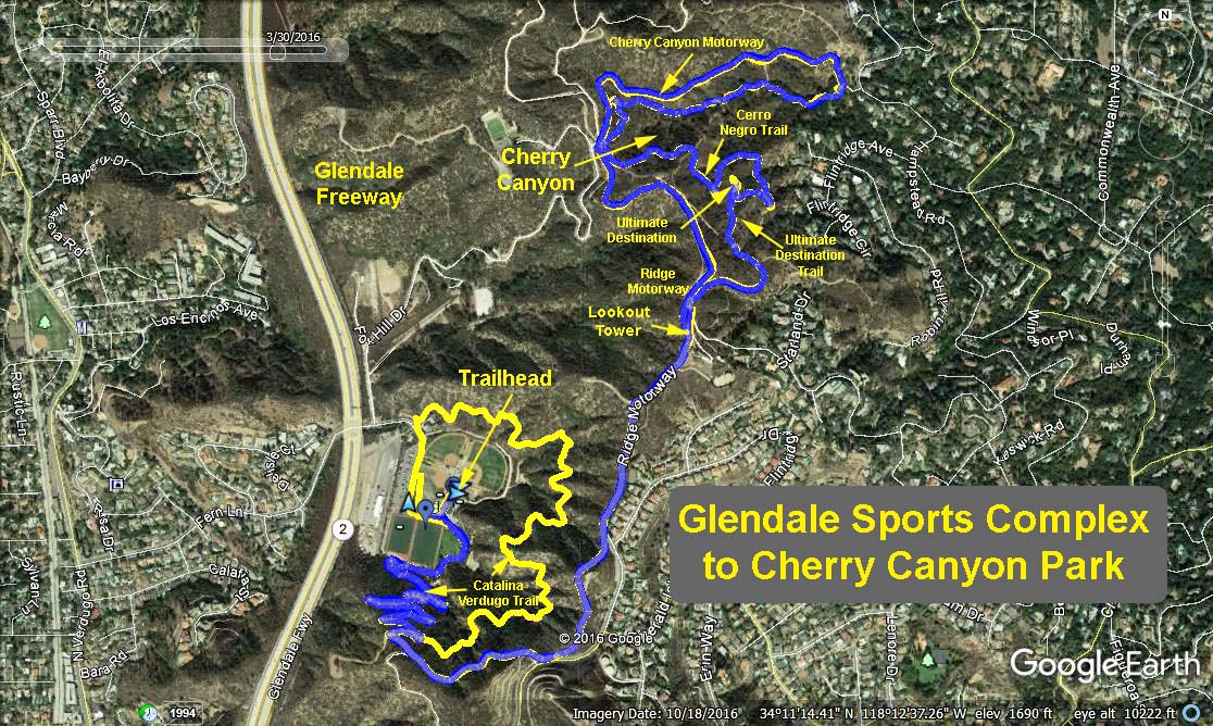
Distance: 6.5 mile loop with options for extra mileage
Elevations: Sports Complex 1,250 ft; lookout tower 1,850 ft; Cherry Canyon 1,300 ft
Trailhead Directions: Glendale Sports Complex is located at 2200 Fern Lane in Glendale. From the South Bay take 110 N to 5 N to 2 N. West Valley take 101 S to 134 E to 2 N. Orange County take 5 N to 2 N. Exit the northbound 2 at Mountain Street and turn left. Travel down to the bottom of the hill and turn right on Verdugo Road. Keep right at the fork to continue on Verdugo Road about a mile to Fern Lane. Turn right and the Sports Complex is located at the end of Fern Lane. We will meet in the upper parking lot across from the soccer fields. Restrooms are located adjacent to the nearby administration office.
Basic Hike: Mountain Do Trail to Catalina Verdugo Trail to Ridge Motorway to Ultimate Destination Trail to Cerro Negro Trail to Cherry Canyon Trail to Cherry Canyon Motorway to Ridge Motorway and back.
We will eat our refreshments on the tables next to the administration office.
Glendale Sports Complex Trails
Google Earth - Glendale Sports Center
Updated: 2022-10-12