Hike #1499
Baden Powell from Dawson Saddle
August 17, 2022
Hike Leader: Dan Bergstrom
Meet at 8:00 am for start at 8:30 am.
Rabbits will hike at 7:00 am.
Please print your own hike descriptions and maps.
Round trip mileage approximately 9 miles
Elevation gain approximately 2,400 feet.
Directions to Trailhead: Take Fwy 210 to La Canada Flintridge. Take Hwy 2 (Angeles Crest Hwy) north. Dawson Saddle is at mileage paddle 69.59 (however the last mileage paddle is at 69.00), 45.2 miles from 210 freeway turnoff (a little more than 1 hour driving time). Parking is on the North side of Angeles Crest Highway.
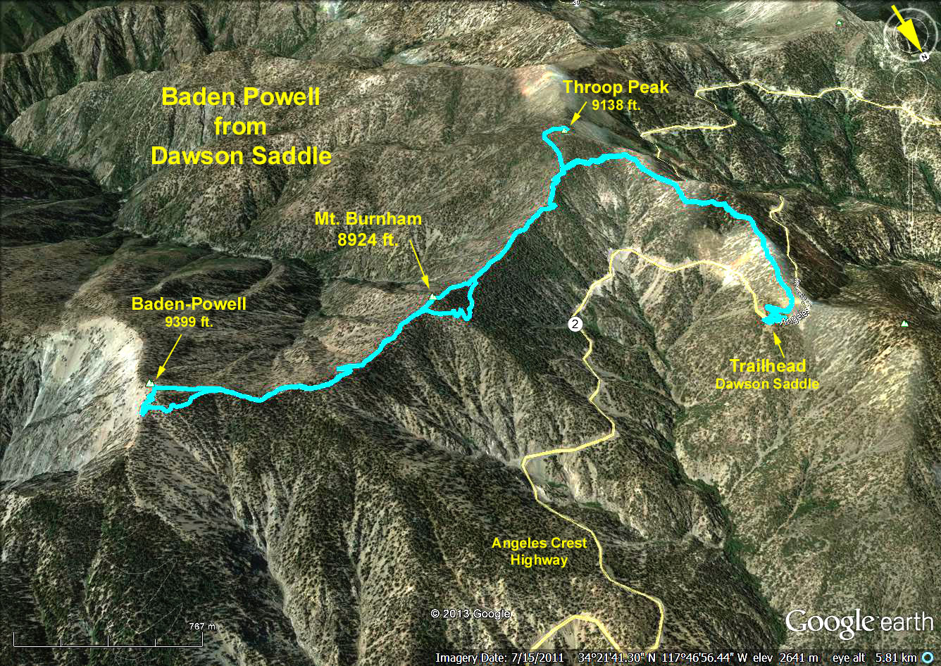
Hike Details: Starts at approximately 7,900 feet elevation. You take Dawson Saddle Trail approximately 1.8 miles to its intersection with the PCT (approximately 8,800 feet elevation). This first stretch is through a pine and fir forest. Turn left (NE) at the intersection and go 2.5 miles on the PCT to the summit of Baden-Powell (the last part is a rather steep for a few hundred feet to the top of the 9,399 foot peak). Lunch at the top and return the same way.
Variations on the standard hike: Throop Peak (9138 feet elevation) is near the intersection of the Dawson Saddle and PCT trails. This can be an added 350 feet climb either on the way up or back for the ambitious or a final destination for those desiring a shorter hike (this would make an approx. 4.5 mile round trip, 1300 feet elevation gain hike). Those wanting a short hike but not wanting to climb Throop could just turn right at the PCT junction and walk a little distance on a relatively flat part of the PCT, eat lunch at a convenient place and return the way they came.
Google Earth Photo - Baden Powel from Dawson Saddle
Updated: 2022-07-30