Hike #1484
Mount Washington
April 27, 2022
Hike Leader: Jim Carlin
Meet at 8:00 am for start at 8:30 am.
Please print your own hike description.
GPS Data:
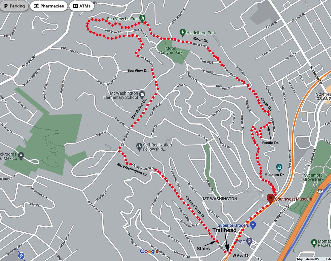
Distance: 4.2 miles RT
Elevation Gain: 630 ft.
History: In the late 1800’s, Mt. Washington was sub-divided by realtor Robert Marsh who, with Arthur St. Claire Perry, built an incline railway to get residents as well as home buyers up and down the hill. At the top of the railway, they built the Mt. Washington Hotel which was completed in 1908. In 1925, Paramahansa Yogananda acquired the hotel, and converted it into the Self Realization Fellowship’s headquarters.
Directions to Trailhead: We will meet at the intersection of Ave 43 and Marmion Way. The tracks of the Gold Line run parallel to Marmion Way. Street parking is available along the track side of Marmion Way or along Ave 43. This intersection is reached off the 110 Freeway via the Ave 43 exit. Directional signs to the Southwest Museum (unfortunately closed at this time) will bring you near to the meeting point.
Amenities: Limit your fluid intak. There are no dependable restroom facilities other than some rent-a-cans set up along the way to service workmen. I'm sorry about that. Had the museum been pen we would have had facilities for relief as well as picnic benches to have our after hike fellowship session.
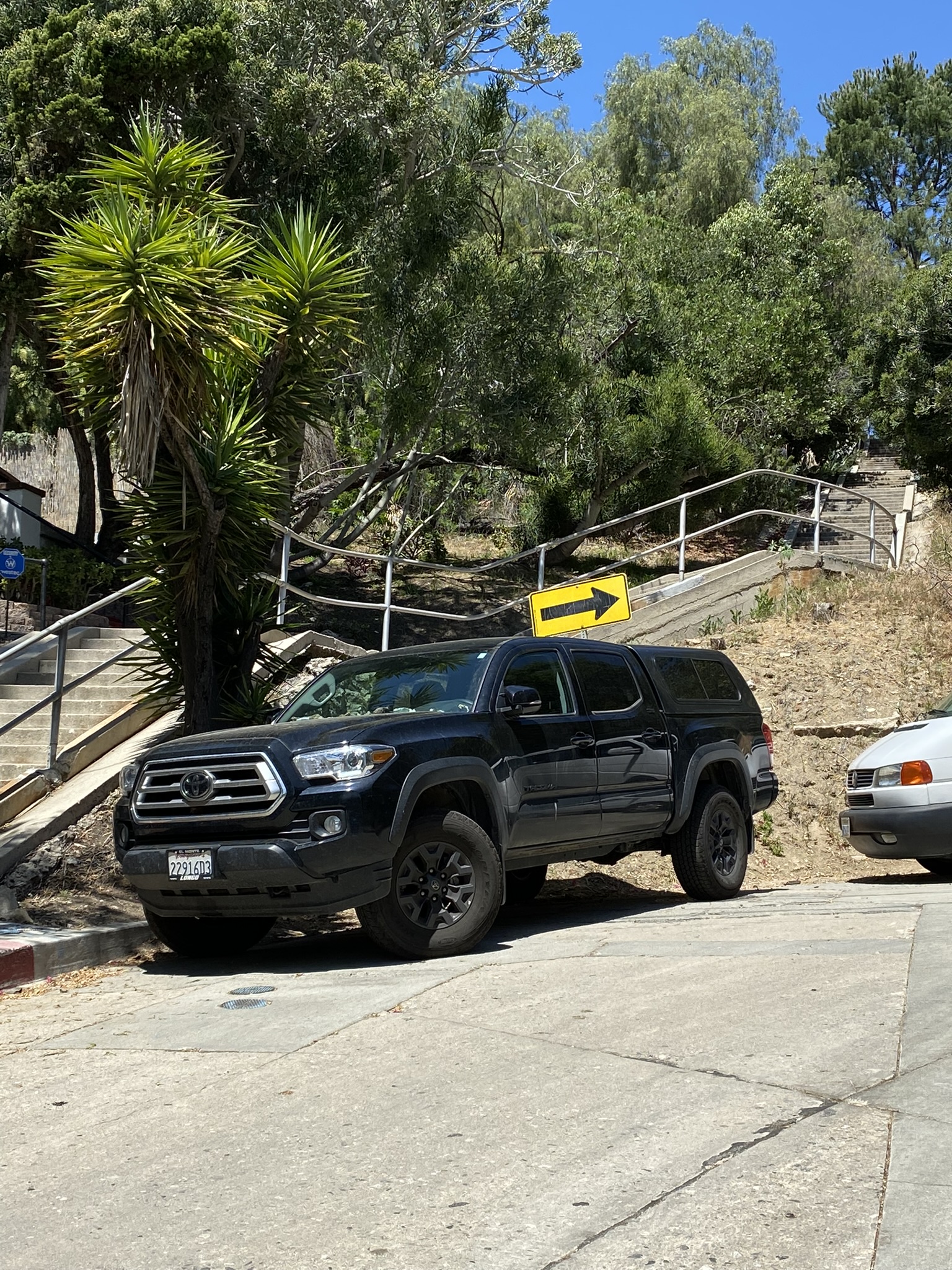
The Hike: We will be on pavement most of the way (some dirt - gravel for 0.1 mile which is pretty level) so street shoes should be OK. We climb up Ave 43 until reaching a stairway which begins off to our left. These stairs steeply march up the hill to Canyon Vista Drive, and were to replace the tracks (torn up in 1919) of the Mt. Washington Railway. Two cars were pulled up and down by cable running under wood planking.
Continuing straight ahead from the top of the stairs on Canyon Vista Dr. we eventually reach a four-way intersection. Continuing straight ahead, we find that we are now on Mt. Washington Dr. We continue on Mt. Washington, along a fence-lined walkway on the left side of the road, until we reach San Rafael Ave. where we turn right as we crest the mountain (940 ft.) and we soon see the iron gate of the Self Realization Fellowship on our right. The gates are open from 11:00 AM to 3 PM, probably too late for a visit during the hike. It is definitely recommended that one stroll the grounds and rest in one of their meditation gardens perhaps after the hike.
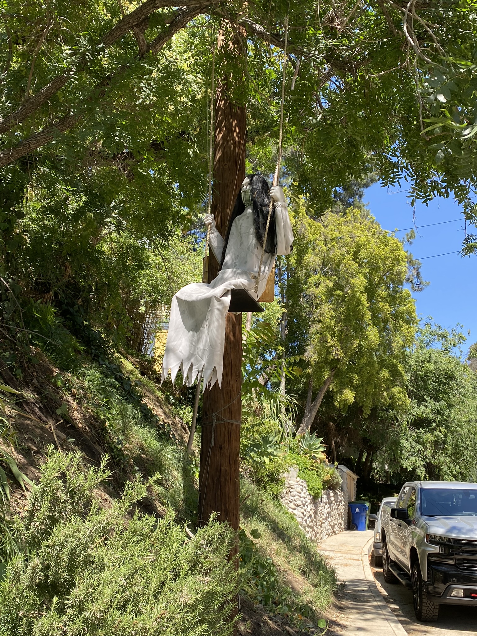
There are also "art forms" to be see along the way: a suspended triangle rotating in the wind, stone ducks, and a fully dressed female manikin swinging on a swing.
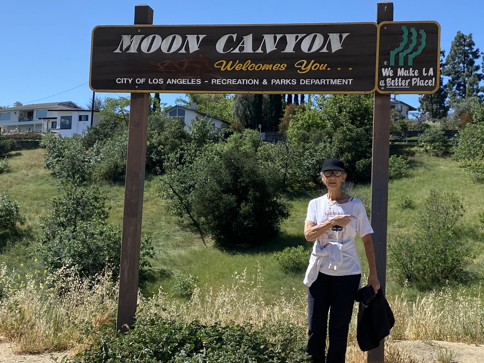
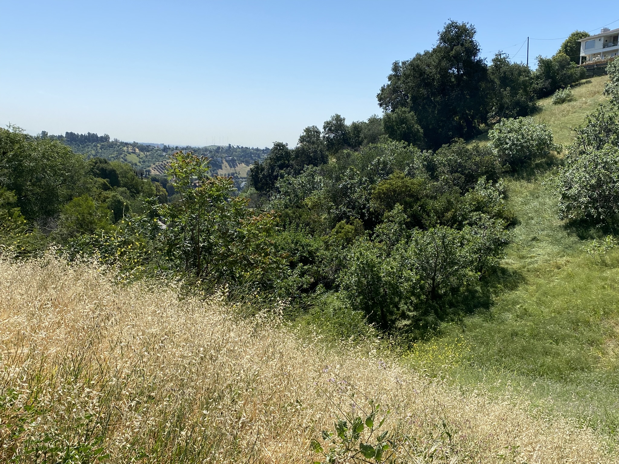
We continue along San Rafael Ave. past the Mt. Washington School (on our left). We soon reach a zig-zag 4-way intersection with Sea View Ave. Walk straight ahead through the intersection ending up on Sea View Ave. Sea View Lane soon becomes a dirt road which traverses around a knoll and offering magnificent views of Los Angeles. The dirt road ends at Moon Ave. on which we begin our descent off the mountain. There is even a "Moon Canyon" which is nothing more than a grass filled gully, but gives you bragging rights that you walked on the moon.
We continue on Moon Ave. until it intersects with San Rafael Ave. where we veer left and then right to stay on Moon Ave (the downhill choice). Moon Ave. soon becomes Crane Blvd. Crane Blvd. passes a number of side roads leading uphill to our right – one of the last of which is called Rustic Dr. Turning right on Rustic, we continue our descent on Rustic Dr. which eventually becomes Museum Drive ending back at the museum driveway.
Continue to Marmion Way, turn right and return to the trailhead at Ave 43.
Updated: 2022-04-24