Hike #1472
Deukmejian Wilderness Park
January 26, 2022
Hike Leader: Ted Baumgart
Please print your own hike descriptions and maps. This will save the hike leader the inconvenience and cost of providing descriptions/maps to you all.
Trailhead Directions: For GPS purposes, the Park is above 3429 Markridge Road, La Crescenta 91214.
From the 210 Freeway, exit at Pennsylvania Ave. and head north to Foothill Blvd. Left on Foothill, and right on New York Ave. Continue north on New York until it dead ends at Markridge. Turn left and then the next right into the park. Drive north and park in any of the lots near the top of the hill. Parking is free. There are restrooms at the park.
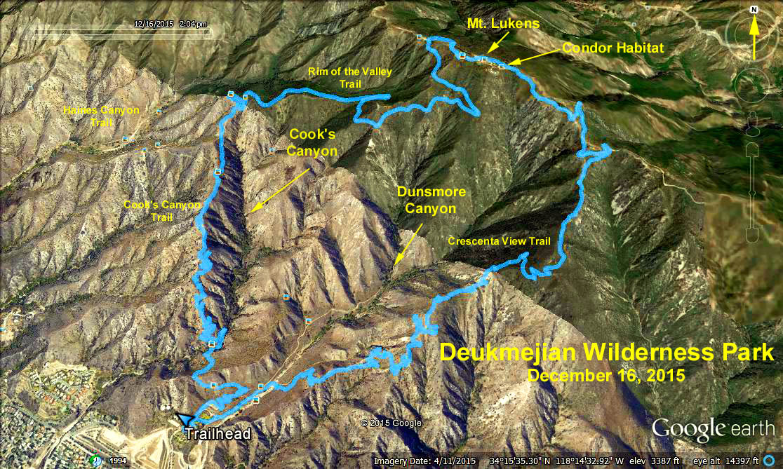
Hike 1 (Ted's Map 1): Ascend then go westward (clockwise) on the first leg of the Le Mesnager Trail up to the Cooks Canyon Trail. Pass over a stream bed in a shady glen. Continue upward to the Haines Canyon fire road (overgrown for 20 years), then retrace your steps back down.
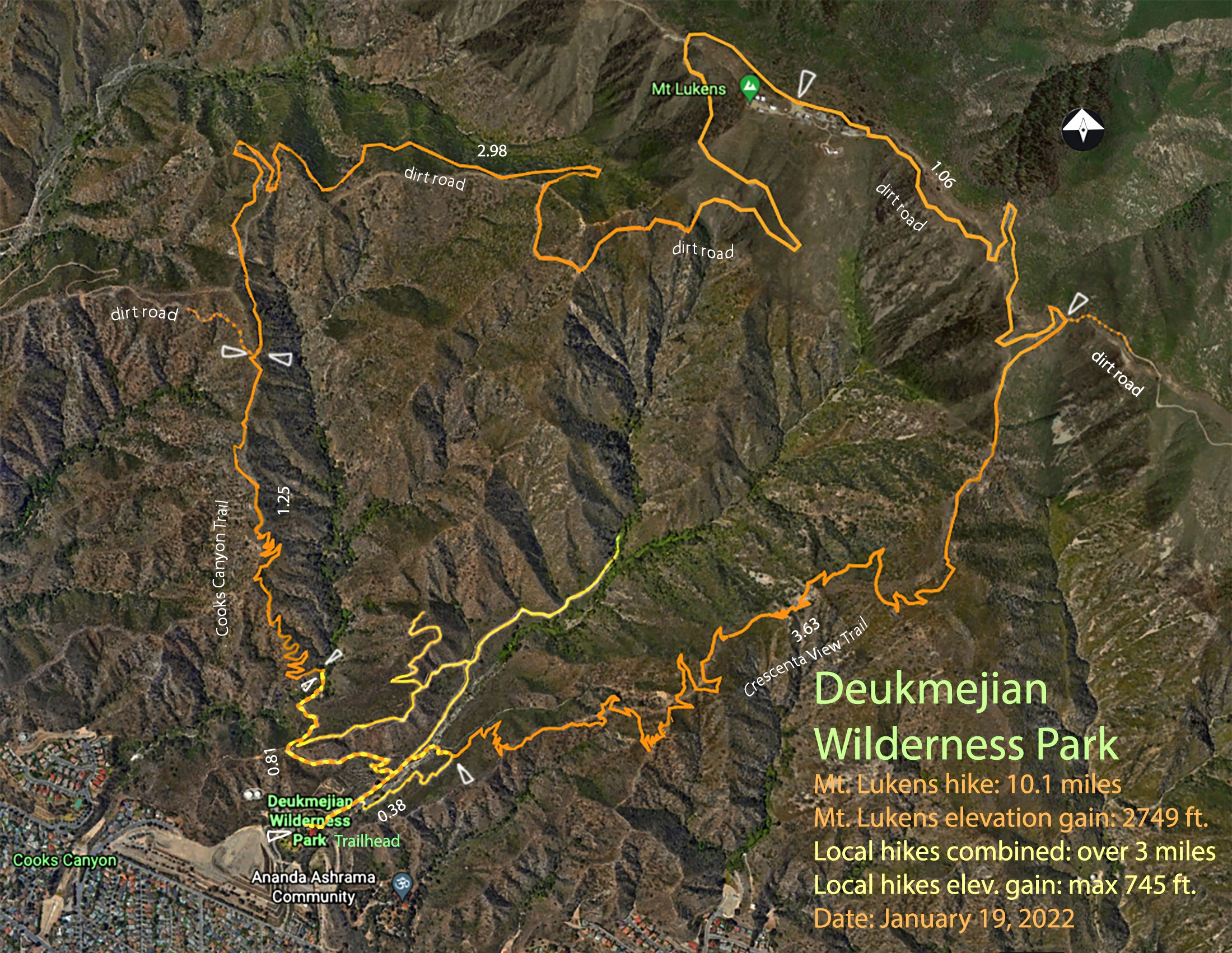
Hike 2 (Ted's Map 1): Ascend as in hike 1 to the fire road but go east (turn right) and continue onward to the top of Mt. Lukens (5,074 ft.), the highest point in Los Angeles City. From there continue eastward on the fire road about 1 mile looking for a dirt road on the right. Take it to the end and look carefully for the Crescenta View Trail that tends very slightly leftward past the nearly ground level concrete water tank to your left. Then soon at a trail junction turn right and head down to Deukmejian Wilderness Park.
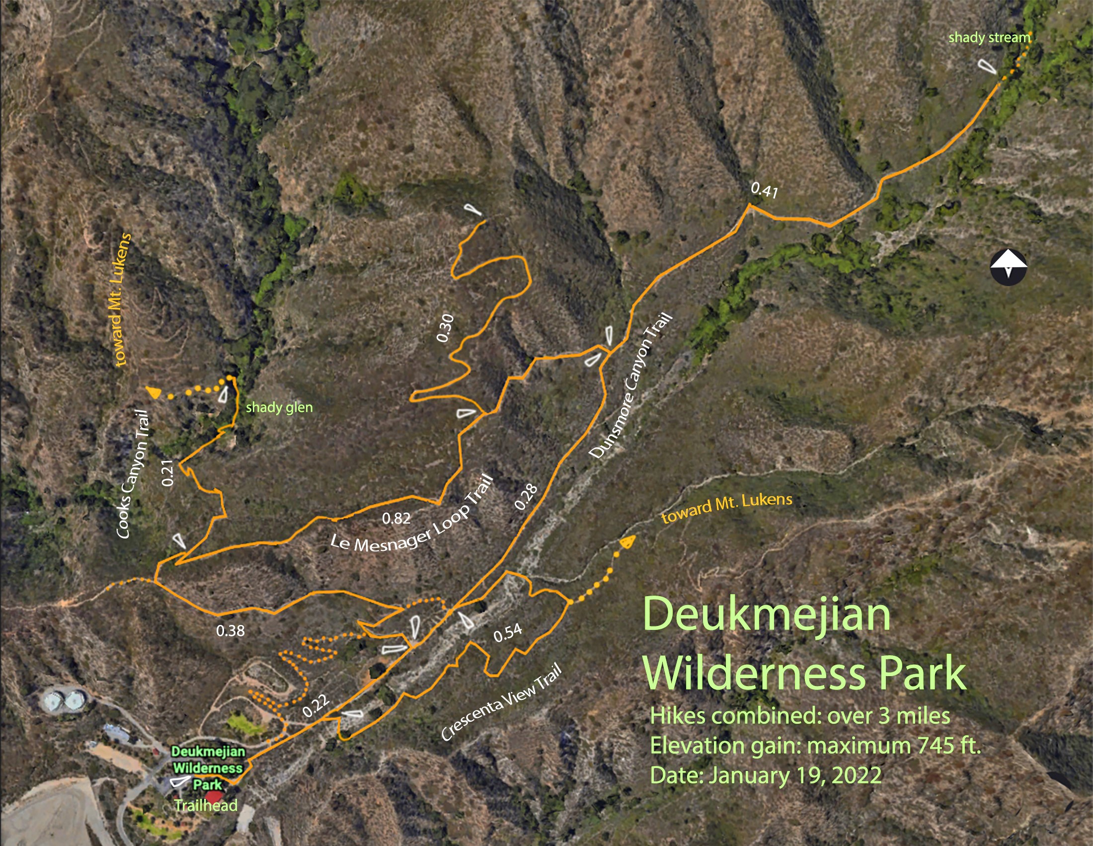
Hike 3 (Ted's Map 2): Easier hiking within the Park: The Dunsmore Canyon trail is a spine with two offshoot loops attached, the Crescenta View Trail to the right and the Le Mesnager Loop Trail to the left. Add several short ‘finger’ hikes by continuing to the top of the Dunsmore Canyon Trail, two more off from the Le Mesnager Loop Trail, one being a brief foray on the Cooks Canyon Trail to its shady glen and back.
GPS Data:
Hike 1: RT Distance: 5 mi.
Max. Elevation Change: 1183 ft.
Hike 2: RT Distance Loop: 10 mi. Max. Elevation Change: 2746 ft.
Cum. Elevation Gain: 2900 ft.
Hike 3: RT distance: 3.6 mi max, Max Elev. Change 745 ft.
Google Earth Photo - Deukmejian Wilderness Park
Updated: 2022-01-20