Hike #1380
October 10, 2018
Mt. Waterman from Buckhorn
Hike Leader: Sam Prum
Meet at 9:00 am for start at 9:30 am
Please print your own hike descriptions and maps. This will avoid the inconvenience and save costs to the hike leader.
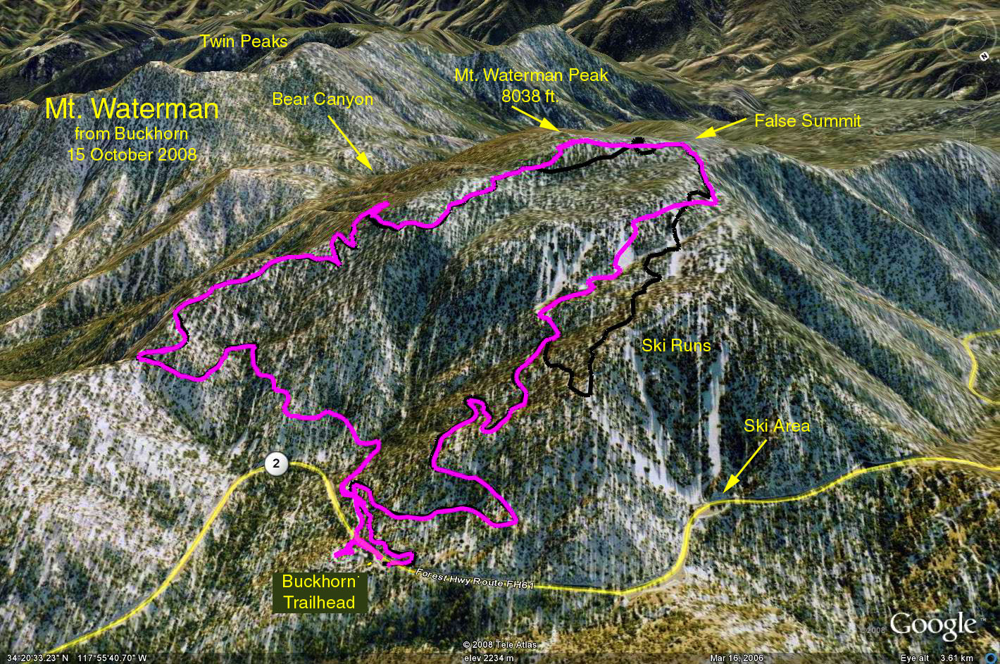
Summary: The hike is along the nice but thinly forested high country of the Angeles National Forest. The basic hike is an out and back to the ridge that forms the summit of Mt. Waterman at 8038 feet. A bit longer version allows completing a loop by returning down the dirt road that is part of the Mt. Waterman ski area.
Waterman is an elongated, broad-summited mountain with three high points. The highest point lies near the southwestern edge of the summit plateau. From here, you are rewarded with fine views of the western San Gabriels and the depths of Devils Canyon.
History: In 1889 Bob Waterman, his wife Liz and Commodore Ferry Switzer took a trip across the San Gabriels. Enroute they scrambled up the highest mountain in the vicinity to get their bearings, built a cairn and left a register. They named the mountain in honor of Liz, Lady Waterman Mountain. When the USGS mapped the mountain, they left off the “Lady” part. Bob Waterman tried for many years to get back the full name without success.
Directions to Trailhead: Leave the 210 freeway at Highway 2, the Angeles Crest Highway. Continue up the Angeles Crest Highway until mile marker 57.8 where there will be a small parking turnout on the uphill side. There is a larger parking area 100 feet further on the downhill side. Park at either turnout. The party will be at the Buckhorn day use area, which is a few hundred feet past the hike parking areas. There are no rest rooms at the trailhead, but there are at Buckhorn day use area. Print the maps below for your use. Use your Golden Age Passport for parking.
Hike: Begin the hike by taking the upward trail from the smaller uphill parking area. Bear in mind that the correct trail is the one furthest to the east (left). After about a quarter of a mile the trail will cross the fire road, which will be the return for those who complete the loop version. Continue up the trail and at a little less than 2 miles there will be a first look down at the Los Angeles basin. A bit further a junction with the trail that leads to Twin Peaks will be reached. Only real tigers should choose to go toward Twin Peaks. Turn right to continue up to Waterman. As the ridge like summit of Mt. Waterman is approached there are trail choices to your left, and the higher choices will get you to the boulder outcroppings that form the summit. Returning as you came will result in a 6-mile hike with a gain of 1250 feet.
Those wishing to complete the 7.5 mile loop should continue west along the crest and drop down a bit to find the ski areas upper dirt road. Follow the dirt road down through the ski area to the crossing of the trail near the trailhead.
Google Earth Photo - Mount Waterman
2018-10-02