Hike #1370
July 18, 2018
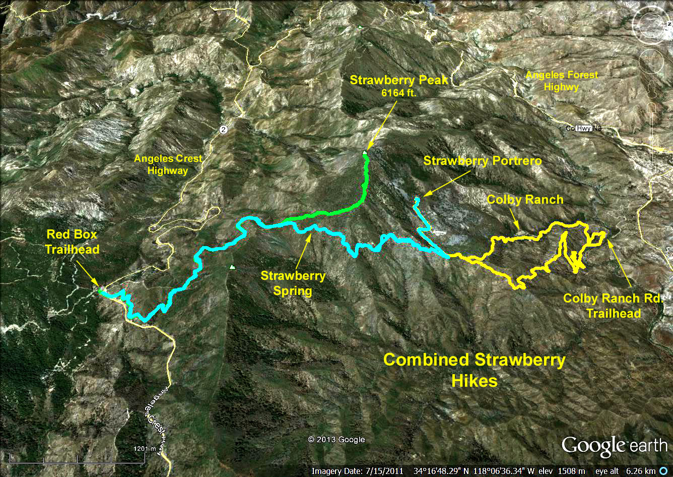
Red Box to Strawberry Portrero
Hike Leader: Rich Frederick
Meet 9:00 am for start at 9:30 am
Please print your own hike descriptions and maps. This will avoid the inconvenience and save costs to the hike leader.
GPS Data:
Distance: 9 miles round trip.
Elevation gain = 1200 ft.
Delta elevation (Red Box to Josephine saddle) = 450 ft.
Delta elevation (saddle to Portrero) = 610 ft.
Directions to Trailhead: Meet at Red Box Station at mileage paddle 38.38 on the Angeles Crest Highway (about 14 miles from I-210 at the Mt. Wilson road turn off). There are restrooms at Red Box.
The Hike: From Red Box we cross the highway and walk east along the left shoulder of Angeles Crest Highway to a fireroad slanting left up the hillside. We continue up the eroded bed of the road for 0.6 miles to reach a trail on the left. From there the trail switchbacks up to a saddle due south of Mount Lawlor's summit, and from there on uphill to Josephine Saddle on the northwest shoulder of Mount Lawlor. At this point we have climbed almost 600 ft. and hiked approximately 2.3 miles.
Bypassing the trail to the left (climbs to the peak of Strawberry), we continue beyond the saddle on the same trail we used to get there, getting to Strawberry Springs in approximately 1 mile dropping 400 ft., then steeply dropping another 200 ft. into a forested gully. At the low point, turn sharply left on a side trail reaching the lower meadow of the Portrero in about 1/4 mile. Continue another 1/2 mile past a second small meadow to the largest clearing where we'll have lunch. We return to the trailhead by retracing our steps.
Google Earth photo - Combined Strawberry Hikes
2018-06-20